| |
|
| |
|
| |
|
|
|
|
|
|
| |
 |
|
 |
 |
| |
|
|
|
| |
|
Trekking and hiking on Mount Amiata | Bagno Vignoni, an immersion in the Val d'Orcia
|
|
|
|
| |
|
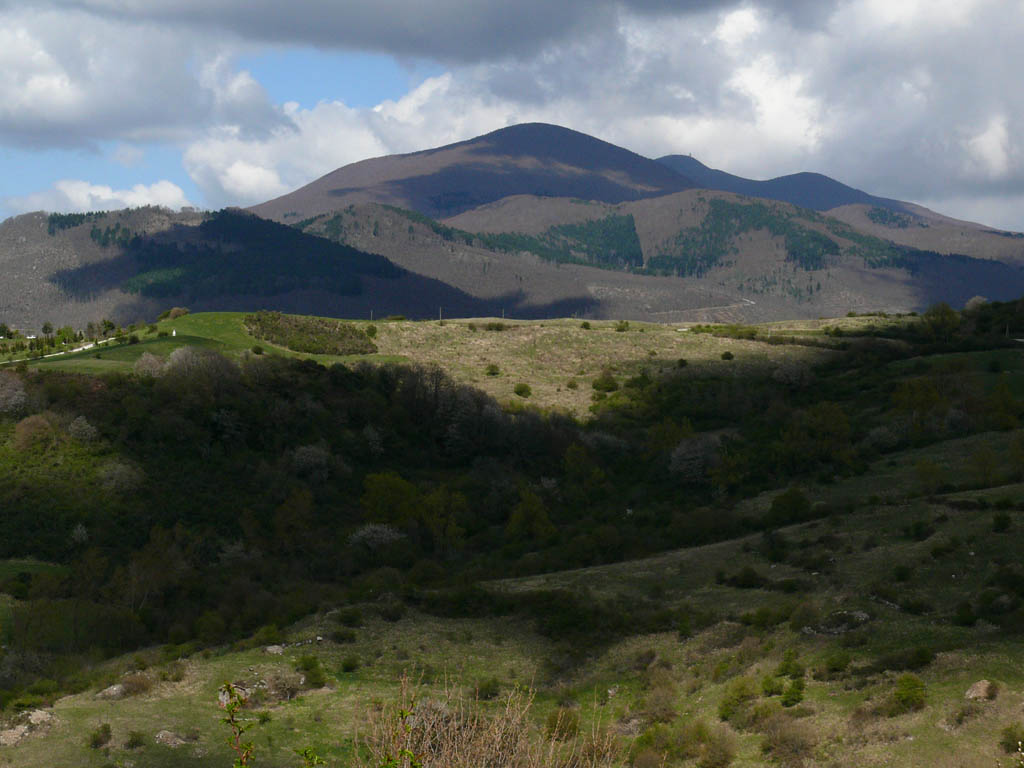
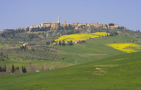
| Monte Amiata
Bagno Vignoni
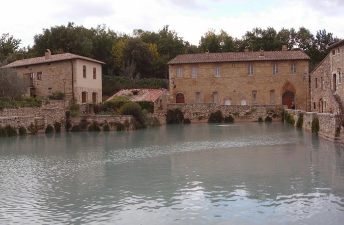
A few kilometers from San Quirico d’Orcia is Bagno Vignoni, a small spa of medieval origin, although it was already know in Roman times. The fascinating tiny village is built around its scenic “piazza of water”, a large pool closed on three sides by the town walls, one metre and a half tall whith water that flows at 52°. This huge pool of thermal water that in the cold winter evenings, with its vapors rising into the night air, makes this a most enchanted place, was the setting for Andrej Tarkóvskij's film Nostalgia.
A typical loggia supported by pillars in travertine marble closes the fourth side of the baths. Legend has it that Saint Catherine, after whom the loggia takes its name, used to bathe in these waters, as did members of all the great noble families of Siena.
|

|
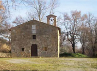
Chiesa di San Giovanni Battista, Bagno Vignoni, San Quirico d'Orcia[0]
|
Located on a hill surrounded by the valley of Orcia river, that flows south of the village, Bagno Vignoni is four kilometres north of Castiglione d'Orcia, 5,5 south of San Quirico d'Orcia, 13 south of Pienza, and 50 south of Siena. The central square of Bagno Vignoni, in which is located a large pool (Baths of St. Catherine), is named Piazza delle Sorgenti (i.e.: "Springs' Square"). The upper side of the village is named Vignoni Alto (i.e.: Upper Vignoni).
GPS: +43° 1′ 42.35″, +11° 37′ 9.89″
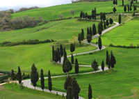
There's a lovely walk connecting Bagno Vignoni with Vignoni Alto, where you can either turn back or hike on towards Castello di Ripa d'Orcia for a signed out round walk which will take you back to Bagno Vignoni (10km).
Watch the magical, almost surreal atmosphere in Bagno Vignboni, immortalised in the Russian director Andrej Tarkóvskij's film Nostalgia.
Movies in the Val d'Orcia | Watch Bagno Vignoni in Tarkovsky's film Nostalghia
Bagno Vignoni, an immersion in the Val d'Orcia
|
|
|
|
| |
|
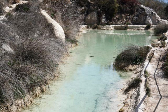 |
Bagno Vignoni, Parco dei Mulini [1]
|
POINT OF DEPARTURE AND ARRIVAL: Bagno Vignoni (Tourist Office at the entrance of the village), parking available. (Circular path).
LENGTH: about 12 Km.
DURATION: 4 hours.
TYPE OF ROAD AND LANDSCAPE: Dirt road and forest paths through olive groves, vineyards and other courses of thermal water and thermal water falls in Bagno Vignoni.
DEGREE DIFFICULTY: medium-difficult (The road at the beginning of the trail, toward Vignoni Alto, runs steadily uphill and is sunny and quite tiring). DIFFERENCE TOTAL: 270 m approx.
SIGNS: Occasionally signs indicative of metal signs Red and white. POINT RESTAURANT: A Bagno Vignoni there are several bars and restaurants |
|
The route starts from the tourist office located at the entrance of Bagno Vignoni. Take the paved road in the direction indicated by the sign of farmhouses. The asphalt road leads straight into the dirt and get to Vignoni Alto after about 40 minutes of ascent through olive groves and vineyards. We let Vignoni Alto on the right and continue straight. In front of the farm Bellaria there is a junction where you turn left towards Castello Ripa d'Orcia. Now we pass the farm Poggio Grande, to farms and Poderuccio Savino, always in the direction of Castello Ripa d'Orcia. Eventually we arrive in front of a source of drinking water: going on the right you come to the Castle of Ripa d'Orcia. (You can see the castle from the outside, because, being a structure and then private property, is not open to visitors.) From the water source the trail continues: on the road to the left in the direction of Bagno Vignoni. Shortly after you reach another junction where you have to keep to the left and down through the scrub along a gravel path. Find your way with red and white signs. Once in the valley you have to cross a stream. (The suspension bridge on our right that would cross the river Orcia, must be restored.) Our route continues straight along the main road and now goes uphill. You then come to a field. Here you can take the direction of the river until you get to another field. Here follow the road to the right. Keep following the signs red and white until you get in front of a stone quarry. Across the former industrial area is reached immediately to the waterfalls of thermal water of Bagno Vignoni. Climb the stairs on the slope to reach the village and then the car park.[1]
Trekking sul Monte Amiata | Da Bagno Vignoni, un'immersione nella Val d'Orcia
Trekking and hiking on Mount Amiata | Bagno Vignoni, an immersion in the Val d'Orcia
|
|
Enlarge map Val d'Orcia |
|
|
|
|
|
| |
|

Itinerary in the great scenery of the Val d’Orcia. The hike from Bagno Vignoni to Rocca d’Orcia is absolutely stunning. The crossing of the Val d'Orcia follows the old Via Cassia for some short stretches but then climbs up to Rocca d’Orcia in a landscape that becomes increasingly wild and solitary.
Trekking in Tuscany | Circular walk Bagno Vignoni, Vignoni, Ripa D’Orcia and Rocca d’Orcia | 17,5 km
Itinerary in the great scenery of the Val d’Orcia, between Bagno Vignoni, Vignoni, Ripa D’Orcia and Rocca d’Orcia
There is a good, shorter alternative, avoiding the climb to Ripa d'Orcia and Rocca d'Orcia, folllowing the Orcia river instead.
Circular walk | Anello Bagno Vignoni – Vignoni Alto Anello | 9 km, 3 hours

The area of the Valle d'Ombrone incorporates the perfect harmony for man and nature.
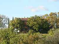
Podere Santa Pia is situated in a hilly and unspoilt land, surrounded by woods, olive groves and vineyards. The house has 4 bedrooms and 2 terraces and has a fully equipped kitchen and a big living room.
Case vacanza in Toscana | Podere Santa Pia
|
| |
|
|
|
|
|
|
|
Podere Santa Pia |
|
San Quirico d'Orcia, Cappella della Madonna di Vitaleta
|
|
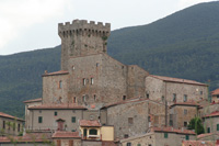
Rocca di Tentennano
|
|
|
|
|
|
Pienza |
|
Pieve di Santa Maria dello Spino |
|
San Quirico d'Orcia
|
| |
|
|
|
|
|
|
|
|
|
Monticchiello
|
|
|
|
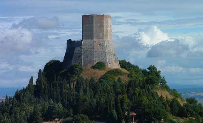
Rocca d'Orcia |
 |
Podere Santa Pia is situated in a hilly and unspoilt land, surrounded by woods, olive groves and vineyards, where the Monte Amiata hills slope to the Maremma plain and the sea can be seen on the horizon, up to Montecristo and Corsica
|

Monte Amiata photo gallery
|
 |
|
 |
|
 |
| Abbazia di San Salvatore |
|
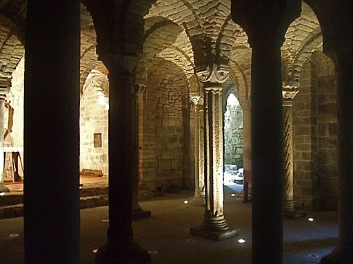
Abbazia San Salvatore di Monte Amiata, La cripta longobarda
|
|
Foresta di faggio, Prato della Contessa |
| |
|
|
|
|
Trekking and hiking on Mount Amiata | Trails to discover the beauty of Mount Amiata (Eng)
|
Bagno Vignoni, an immersion in the Val d'Orcia [LENGHT: 10 Km. DURATION: 3 hours circa]
From Vivo d’Orca to the hermitage and these spring of Vivo [LENGHT: 10 Km. DURATION: 3 hours circa]
From Seggiano to Potentino Castle [LENGHT: circa 13 Km. DURATION: 3, 5 hours]
|
Trekking sul Monte Amiata | Sentieri per scoprire le meraviglie del Monte Amiata (It)
|
Dal Vivo d'Orcia all'Eremo e all'Ermicciolo fino alle sorgenti del Vivo [LUNGHEZZA: 10 Km circa. DURATA: 3 ore circa]
Nei castagneti di Arcidosso [LUNGHEZZA: 6.2 Km. DURATA: 3 ore circa]
Da Tepolini attraverso i castagneti de.."la strada della castagna" [ LUNGHEZZA: 4.2 Km circa. DURATA: 1 ora e 1/4 ]
Da Abbadia San Salvatore a Piancastagnaio [LUNGHEZZA: 13 Km circa. DURATA: 3 ore 1/2 circa ]
Attraverso la riserva naturale de "il Pigelleto" [LUNGHEZZA: circa 10 Km. DURATA: 3 ore 1/2 circa ]
Dal parco faunistico del Monte Amiata alla cima del Monte Labbro [LUNGHEZZA: circa 6,5 Km. DURATA: 3 ore circa]
Da Bagno Vignoni, un'immersione nella Val d'Orcia [LUNGHEZZA: circa 12 Km. DURATA: 4 ore circa ]
Da Semproniano al piccolo borgo di Rocchette di Fazio [LUNGHEZZA: circa 10 Km. DURATA: 3 ore e 1/2 circa ]
Da Seggiano al castello di Potentino [LUNGHEZZA: circa 13 Km. DURATA: 3 ore e 1/2 circa ]
Dal Prato delle macinaie alla vetta del Monte Amiata [LUNGHEZZA: circa 7 Km. DURATA: circa 2 ore e 1/2 ]
|
|
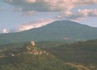
Monte Amiata [2]
|
Bibliography
Aldo Mazzolai, Guida della Maremma. Percorsi tra arte e natura, Le Lettere Firenze, 1997;
Giuseppe Guerrini (a cura di), Torri e Castelli della Provincia di Grosseto (Amministrazione Provinciale di Grosseto), Nuova Immagine Editrice Siena, 1999.

[0] "Chiesa bagno vignoni" by The original uploader was Vignaccia76 at Italian Wikipedia. Licensed under Copyrighted free use via Wikimedia Commons.
[1] Sourcee: www.amiataturismo.it
[2] Fonte fotografica:"Amiata z04" door Zyance - Eigen werk. Licentie CC BY-SA 3.0 via Wikimedia Commons. |
|
|
| |
|
|
|
| |
|
|
|
| |
|
|
|
| |
|
|
|
| |
|
|
|
| |
|
|
|
|
|
|

