
 |
|
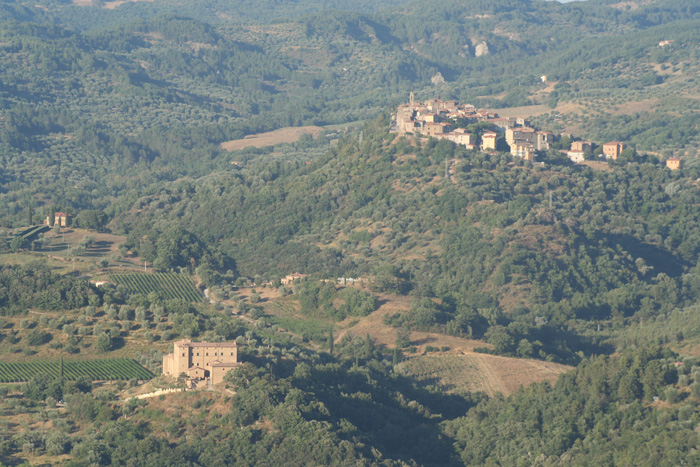
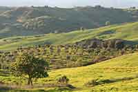
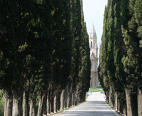
| Castello di Potentino and Seggiano, view from Montegiovi | |
|
This route starts at the hotel / restaurant “Il Cacciatore”. Immediately cross the road SP323 and take the paved road in front (Piagge Altore). Take the road to the right and continue until you reach a small cluster of houses (Piagge) on the right. The paved road becomes a dirt road and now leads out from the small village. Get off the main road down to the river and cross the bridge. Follow the dirt road upstream. At a crossroads, where there is a stone house on the right, follow signs to the right for Spazzavento. The road continues to climb. On a small hill, turn right and continue ignoring the branch on the left. (On our right we can see the village of Seggiano and the background to Castel del Piano). The path descends to a junction where you turn right. Now you walk through the olive groves. Ignore all deviations and stay on the main street. At a T-junction, in a curve, take the road down to the left. Get off keeping to the right of some small stone houses. Cross the bridge that is situated just after crossing the river and Vetra. From here the road is cemented. Continue uphill (left there are cypresses and right the ruins of a farm). This road leads almost immediately in front of a stone cottage. At a T-junction turn right. Shortly after we arrive at a villa in reconstruction: here, at the junction, follow the signs for Seggiano / Pescina. Now you walk on paved road, cross the stream Matrolla and reach the first houses of Seggiano. The Bar "Il Fonte", cross the SP323 and follow the signs indicative that lead in to the country. Walk along Via Trento and Trieste up to a crossing. Here go left to Via Santa Caterina. After the war memorial, in front of the municipal offices, you get to an intersection. (If you follow the main road for about 100 meters on the right, you arrive in the center. Our route instead, at this point continues to the left). Find your way with signs indicative of metal "Comunità Montana" and past the sign outside “Ambulatorio Veterinario (Veterinary Surgery)". The road is getting narrower and leads us out of the country. At this point, where the road turns white to roadbed, follow the signs to the right. The tour continues to the right passing in front of a cross-linked and can walk a little 'along a country lane in Seggiano. This path is flanked on the left by a wooden railing (sign-tree on the right). Eventually he meets again a paved road (to the left is a stone house). Now go left and follow the road leading down to the valley. Shortly after you pass the Mobilificio Amiata. (On the right side of the road there is the image of San Bernardino). We meet again the road SP323. Here you walk to the left, cross the bridge (river Vivo) and immediately follow the indication on the left for the Castle Potentino. This road leads us Agriturismo Poggio Velluto, where we must turn left. The asphalt road again becomes 'massicciata' or roadbed. Finally you reach the imposing Castle Potentino. The castle is owned by the British family Green and unfortunately is not open to the public. The estate is inhabited all year round by the family (descendant of Graham Green) which also produces a good wine. Leave the castle on our left and continue along the vineyard. At a crossroads turn right to the sandy road, which immediately became massicciata. Now you walk through olive trees. This farm track leads almost immediately to a gravel road on which you turn right. From here the view opens over Val d'Orcia. After about 200 meters on the right side of the road there are a couple of oak trees: a great place to stop for a picnic. Keep walking and spending Podere Colombaio. Now follow the road until a T-junction where there are signs indicative of the "Strada del Vino Montecucco". Here turn on the left. Now you walk through a landscape of vineyards. Aun junction follow the signs for "Villa Gaia" in the upper right corner. Then follow the road towards "Oratorio del Colombaio". Let Villa Gaia on the left and follow the main road that becomes ballast. Keep going straight on this road until you reach the small cluster of Poggio Ferro, who is also the highest point of this route (568 m). Poggio Ferro cross and stay on this same road down constantly and leads up to a T-junction in a curve. Here keep right and orientate the signs for Poggio. The SP323 is reached soon there turn left up to the point of departure Poggio al Leccio “Il Cacciatore”.
|
||
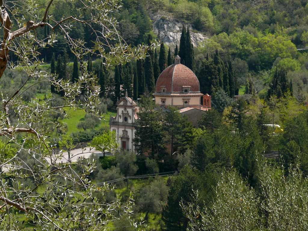
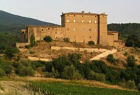
Potentino Castle |
||
| Potentino Castle, a splendid ancient castle, built on an Etruscan site, lies in a secret valley nestled in one of the last undiscovered corners of Tuscany - the Monte Amiata. Run by the Greene family as an old-fashioned Residenza d'Epoca, The Castello di Potentino. The first document to mention the Castello di Potentino is dated 1042. It then belonged to a certain Count Pietrone or Pepone. However, the original foundations are probably Etruscan. Over the centuries the property passed through the hands of many well-known Tuscan families of noble descent - the Tolomei, the Bonsignori, and the the Salimbeni, whom in the company of Contessa Bianchina, received Saint Catherine of Siena as a guest at the castle. At the end of the 16th Century it became a centre for the charitable works of the hospital order of Santa Maria della Scala. After this period of religious activity, the Medici Duke Ferdinando I conceded the estate to Marchese Giovan Battista Bourbon del Monte, famous commander-in-chief of the infantry of the Venetian Republic. His descendants finally sold the castle to a gentleman from Switzerland, Antonio Hemmeler, in 1906. Recently it was purchased and restored by the Greene family, who have given new life to the ancient traditions of the building. Charlotte Horton and her brother, Alexander Greene, whose English roots are literary and artistic, preserve artisan winemaking techniques and a whole way of life in the castle. The Greenes have owned properties in the Tuscan Maremma for over 30 years. Starting with a farmhouse near the coast, they gradually moved inland. Castello di Potentino is their second major project in the Grosseto area. The first was Castello Montempò, set in the heart of the valley near Scansano, were you can see in the background setting, a series of modern windmills as part of a power station. The building of giant wind turbines in one of Italy’s most fashionable wine regions was approved to the outrage of local wine producers. After 10 years, when restoration was completed, vineyards planted and a winery establishedCastello Montempò was sold to the Biondi Santi family. The second castle, Potentino, was discovered in an old guide book. Abandoned, dilapidated, overgrown, the potential was still apparent. It was for sale but had to be bought from 22 different people. Negotiations took a year and agreement finally reached with all the owners. [1] |
|
|
|
||
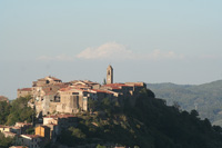
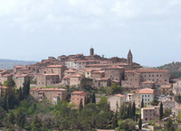
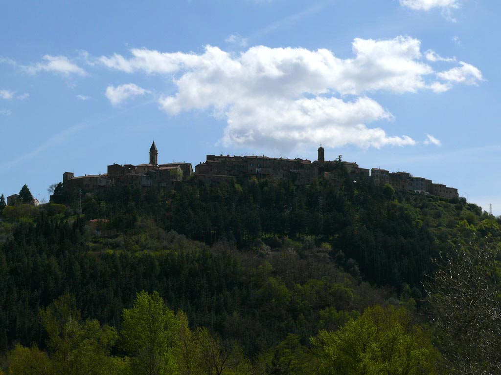
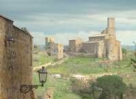
Seggiano, seen from the street to the station of Mount Amiata [3]
|
||
|
||||
 |
 |
 |
||
Podere Santa Pia |
Podere Santa Pia |
Century-old olive trees, between Podere Santa Pia and Cinigiano |
||
 |
||||
Montepulciano |
Villa La Foce |
Castel del Piano, itinerarie |
||
 |
 |
|||
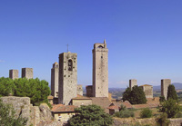
San Gimignano |
Tuscania |
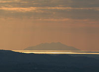
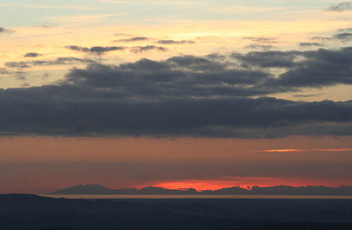
Sunsets in Tuscany |
||
 |
||||
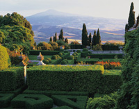
Podere Santa Pia is embedded in the tranquility of the Tuscan country and let you enjoy great views of the Maremma
|
||||
Trekking and hiking on Mount Amiata | Trails to discover the beauty of Mount Amiata (Eng)
|
||||
|
||||
Trekking sul Monte Amiata | Sentieri per scoprire le meraviglie del Monte Amiata (It)
|
||||
Dal Vivo d'Orcia all'Eremo e all'Ermicciolo fino alle sorgenti del Vivo [LUNGHEZZA: 10 Km circa. DURATA: 3 ore circa]
|
||||
[1] Fonte:www.potentino.com [2] Fonte fotografica di Zyance - Opera propria, CC BY-SA 3.0, https://commons.wikimedia.org/w/index.php?curid=4048953 [3] Fonte fotografica di Zyance - Opera propria, CC BY-SA 3.0, https://commons.wikimedia.org/w/index.php?curid=4048825 |
||||