 |
|
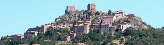
| I T | Roccastrada |
|
| Roccastrada is
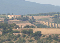
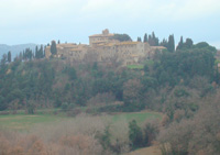
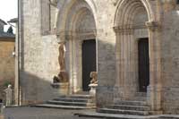
one of the widest Italian communes (28.000 hectares). Situated on the ridge of an intensively cultivated plateau, Roccastrada maintains the aspect of a medieval town, distinguished by the beautiful 13 Church of Saint Nicola in the old part of the town. The Town Hall, the Municipal Library and the Theatre of the Concordi are located in the 19 C new part of the town. Roccastrada, chief village of the district, was built around the 10th century, its main church, Chiesa di San Niccolò, was established around 1283. It keeps two frescos dating back to the sixteenth century: one representing the Annunciation, the other a Madonna with Child. History Montemassi is a medieval village, dominated by an imposing fortification, Montemassi Castle. The castle of Montemasi is, without any doubt, the most famous monument in the territory of Roccastrada, for its importance of historical document (it was represented on the famous fresco situated in the public palace of Siena attributed to Simone Martini) and for the high example of Gothic style architecture that it represents. The castle was repeatedly besieged during the fourteenth and fifteenth centuries and finally conquered in 1328 by the Sienese Republic. Roccatederighi is one of the most interesting and well preserved medieval village of this area, it is mimetically built on huge trachyte rock spurs called "i massi" overlooking the Maremma. We can still notice the remains of its "Cassero"(1) near the Tower Clock, and parts of the ancient walls. At the very top of the village there is a church, Chiesa di San Martino Vescovo, built around the tenth century. Both the village of Sassofortino, where we can notice several doorways carved in the local stone, and Roccateterighi are situated at the foot of Sassoforte, a 787 metres high mount where the remains of a mighty fortress lie: il Castello di Sassoforte. Ribolla has been an important mining centre: lignite was excavated until 1954, when an enormous explosion stopped the coal extraction. The today’s village structure is developed on the basis of the existing mining village. Sticciano
|
|
|
 |
||
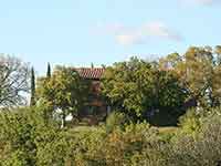
Sticciano [2]
|
||
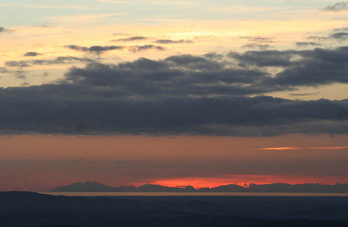
Sticciano stands on a small hill at the centre of the area of Monte Leoni. It is a natural terrace on the plain with extraordinary views. It is like being on a balcony which overlooks the Maremma, the sea and the islands of Giglio, Elba and Corsica. It can be reached only through a road, which is like a route of slow discovery, of increasing wonder. The old town is a meaningful scarcely inhabited medieval town. The very centre of the village is only accessible on foot, with acute corners and narrow passageways. The romanesque church, Chiesa della Santissima Concezione, also known as the church of Santa Musticola, is worth a visit. The church of Santa Musticola is made up of a single nave ending in a semicircular apse, with an elevated presbytery and a rectangular bell tower on the right, inside the church, and two interesting portals: the main one with an architrave decorated by two romanic crosses and the lateral one with a decoration made up of mouldings on the jambs and palm trees with crossed leaves on the frame of the double archivolt. Torniella and Piloni are small villages surrounded by chestnut wood trees, they both introduce the visitor the river Farma Valley, a protected area of incredible beauty and peculiarities. On the road to Monticiano, one can reach Torniella. The castle of the Ardengheschi, the vassals of the Aldobrandeschi, forms the stronghold of the town. The Benedictine monastery of San Salvatore di Giugnano, dedicated to San Salvatore, which include only the remains of the crypt and the Cistercian building, is situated at Le Casecce.
|
||
|
||
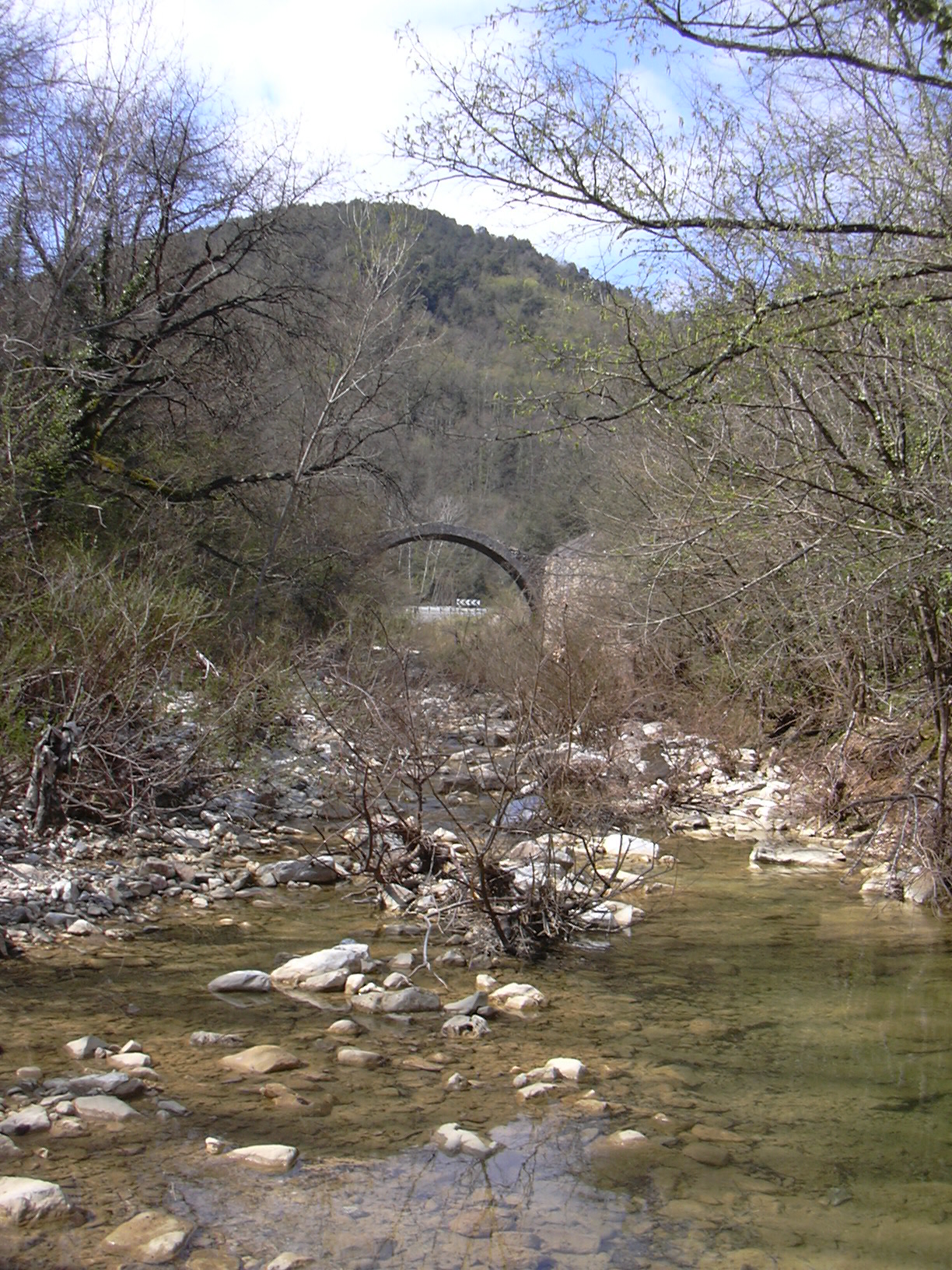
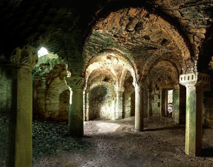
| La Cripta di Giugnano | ||
| Roccastrada borders Campagnatico, Chiusdino, Civitella Paganico, Gavorrano, Grosseto, Massa Marittima, Monticiano en Montieri. The frazioni Sticciano, Ribolla, Montemassi, Roccatederighi, Sassofortino, Torniella and Piloni are part of Roccastrada. |
||
|
Enlarge map |
||
| Roccastrada history | ||
The territory belongs to the area of influence of Roselle since the Etruscan Age and it has remained so in Roman Age and during the Early Middle Ages, always keeping an important agricultural and pastoral vocation. The territorial unity of the southern Tuscia, kept also by the Lombard, was compromised by the endowment that Charlemagne in the year 787 made in favour of the Pope of the lands of the Bishopric Roselle. Roccastrada begun since that time a meeting point between the territories of the Empire and those under the control of Rome, to the advantage of the Aldobrandeschi Family, who enfeoffed and reunited by means of a slow battlements process the entire Maremma. In such a way the Aldobrandeschi succeeded in maintaining till 13th century their possessions, consisting in small, fortified towns, among which the castles of Sassoforte, Montemassi, Roccatederighi are certainly the most characteristic, with their fascinating aspect of inexpugnable strongholds… a world expressing the immobility of an area for a long time feudal, outside the economic development that the centre of Tuscany was living. Siena, between 13th century and the half of 14th century, conquered all the castles of the area, destroying their fortifications because of safety reasons and increasing the marginality of Maremma, which had as well to undergo the effects of famines and pestilences culminating with the Black Death in 1348. The submission to Florence of a depopulated and abandoned territory is as a consequence the effect of an economic supremacy leading to the political subjection in the first half of 16th century. The Medicean domination did not substantially improve the situation and only the Lorena, starting from 18th century, thanks to the resumption of the mining activities, the land reclamations and the administrative and institutional reformations, succeeded to remove the main obstacles to the demographical and economic recovery, for centuries stagnating. |
||
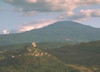
| Montemassi history |
||
 |
||
Montemassi Castle |
||
Montemassi castle is without doubt the most important monument of the municipality of Roccastrada if not of the entire Maremma, due to its importance as a historical document (it is depicted in the famous fresco Guidoriccio da Fogliano at the siege of Montemassi in the Palazzo Pubblico in Siena attributed to Simone Martini) and as a high example of Gothic architecture. Mining history Even when, during the 19th century, the village of Ribolla was born, the relationship between the lignite mine and Montemassi remained indivisible till the closure of the mine. |
||
[1] Foto di Rein Ergo © Traveling in Tuscany [2] Photo by LigaDue, licenced under Creative Commons Attribuzione 3.0 Unported |
||
|
|
||||
 |
 |
 |
||
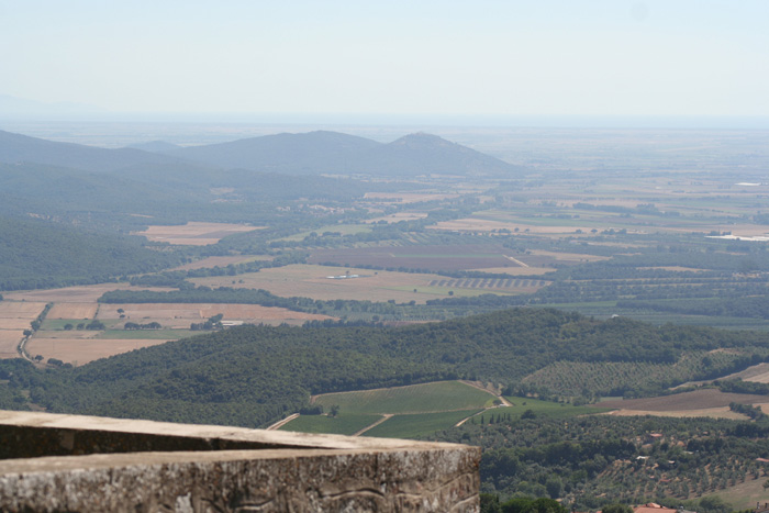
Vista da la Rocca di Campiglia Marittima a le Colline Metallifere
|
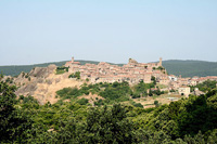
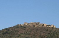
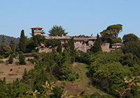
Roccatederighi | Panorama Roccastrada | ||
|
 |
|
||
| Landschaft am Fluss Rosia mit der Brücke Ponte della Pia | Le Roste
|
Le Roste, Montieri
|
||
 |
 |
 |
||
The Merse River near Le Roste, part of the ancient minings in Montieri
|
Sassofortino panorama | Le Roste (particolare) | ||
|
||||
 |
 |
 |
||
|
||||
 |
 |
 |
||
Rocca di Tentennano |
Castello Colle Massari, view from Podere Santa Pia |
Castel Porrona, a charming medieval village dating back to the 11th century, between Cinigiano and Castiglioncello Bandini and Podere Santa Pia |
||
 |
||||
Podere Santa Pia is located 3 km from Castigliocello Bandini, 15 km from Abazziia San 't Antimo and Montalcino, and 1 hour away from the seaside and close to art cities like Siena, Pienza, Montepulciano and San Quirico d'Orcia. |
||||
|
||||
Itineraries. Hiking trails in the Val di Merse
Trekking in and around Roccastrada (eng)
Biking near Roccastrada and Fattoria di Monte Lattaia | Journey into the Middle Ages (GR3) - 106.3 km
Cycling tours in Tuscany Maremma | Balcone sulla Maremma
|
||||
 |
 |
 |
||
Monte Cucco wine region |
Belagaio Castle |
San Qurico d'Orcia |
||
Maps and descriptions available in Podere Santa Pia Kompass map 653 Pienza - Montalcino - Monte Amiata (1:50.000) |
||||
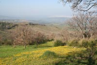
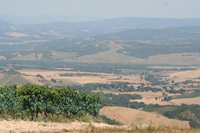
The Maremma is a large area in southern Tuscany. It is a perfect microcosm that stretches between the provinces of Livorno and Grosseto. In the Divine Commedy, Dante Alighieri identified its borders from "Cecina to Corneto" (Tarquinia in Lazio). Maremma is unique because of the variety of its territory: blue sea, long beaches, black rock, hills covered with woods, marshes and flat lands, green hills and natural thermal baths.
|
||||