| |
|
| Main sights are the Church of Santa Mustiola, or Santissima Concezione (10th century), main parish church of the village, church of Confraternita del Sacro Cuore di Gesù (16th century), now transformed, the Palazzo Piccolomini, a medieval building in the old town, and the Villa Tolomei, a former farmhouse of late 19th century.
Development km 18,8 | Time 7.25' hours
Interests | Historical Architectural (La Civitella) | Naturalistic (Mediterranean evergreen Oak wood) | Landscape (La Civitella's area) |
Cultural (plots of land traditionally run)
On leaving Sticciano we find an environment characterised by a typical Mediterranean wood of cork trees. Bushes, heather, cystisus and arbutus cover the emerging rocks; also turkey-oak trees and durmasts are easy to spot. We can see that wood has been a resource for ages: it has been cut for centuries and only a few strong plants are left for reproduction among those, the imposing holm oak tree (Quercus ilex) whose kernels are eaten by wild boar (once they were pigs’ solely food)and its large leafage guests game. On the south slope of Monte Leoni we find the typical Mediterranean macchia(1) once again.
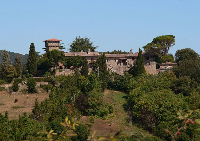
Following the path we come into a wood of maritime pine and we then get to Pian del Muro, a largely cultivated area and from there, following a gravel road, we arrive at the Stazione di Roccastrada (Roccastrada station). The path leads to the strada provinciale (main road), we cross it and we then take another gravel road which is next to a house. We first go through a forest of holm oak trees arbutus heather and cork trees, the wood thickens with turkey oak trees. We walk through a tiny valley, to find at the top of a calcareous hill a farm surrounded by shrubs, we go down the hill to a cultivated area characterized by small fields locally called "Cetine", where olive trees, vineyards and hedges nicely sketch the hills’ sides. The small cottages are typical of our area: with some browsing sheep and goats, chickens, rabbits, a straw-stack: we can easily see the way these small proprieties were once run as they do not differ much from the past. These lands were part of large landed proprieties belonging to the marquisate of the Patrizi-Chigi family of Paganico. The lands were once covered of thick forests which were cut down by the inhabitants under the Marquis permission: the land was first rented and then bought by local people. Turning left we have a great view of Roccastrada; we then get to "La Civitella", a medieval stronghold which has kept many of its original features. Above all a travertine pointed arch situated in the court-yard. Walking on the gravel road, we get near a mound where the castle of Fornoli once stood. Fornoli, together with the villages of Civitella Marittima and Pari, were part of the Ardengheschi county and it is mentioned in an act of the Sienese Republic’s Mayor where it is defined the western and northern border of Grosseto’s territory: " A GESSIS OF SASSOFORTE USQUE A FORNOLI ET A CIVITELLA USQUE A SAXUM…". We soon get to the main road where the hamlet of "Il Terzo" is, and from there to the village of Roccastrada.
Excursion to Monte Leoni
|
From Sticciano it is possible to go to Monteleoni (616 m) on a very pleasant excursion among fields and under wood of Mediterranean trees and plants such as the cork tree and durmast that grow on acid soils(Verrucano rocks).
This excursion is not marked, we therefore need to accurately follow these instructions. We start from the itinerary that leads to Roccastrada station, but as soon as we arrive at the cemetery, instead of following the marks, we carry on the unpaved road that bends right. After having walked up a bit, the road becomes flat.
When it goes up again, on the right we find a private propriety surrounded by a wire-netting with two imposing maritime pines at the sides of the entrance. On the left we can see two roads 20 metres far one another (the first goes down, the second up) and we walk on to find Fonte Vecchia, the Old Fountain, one km far from the village. Ten metres before the wire-netting ends, there is a turning and we take the road on the left. At the next turning we take another road on the left which goes up to a steep slope. The opposite road is connected to this one further up: it is less steep but much longer. At the top of the slope there are two roads on the right: the second one rejoins the less steep and longer road. In this spot we get a great view of the plain as far as the sea, with Sticciano and Montemassi, the two ends of these itineraries. Walking for about 200 metres, on the left we find a gate, we walk for another km (on our left there is a barbed wirenetting).
We turn left walking up, with the netting on our left, on a path that does not follow the road but orthogonally detours it. This is the boundary between the no-hunting zone and the Azienda Faunistica Venatoria "I Murali" as we can see from the signs. At the end of the slope , on the left, we can find a way through the netting, going up 200 metres we get to the top of Monte Leoni, topographic point of the Military Geographic Institute, which is marked with some stones. Just beyond the netting, we have to cross a chain of stones that encircles the top of the mount: these are the ruins of a pre-Etruscan settlement. We are in the middle of a striking wood of turkey oak trees with an under wood of heather and holly trees that are periodically cut.
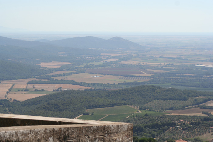
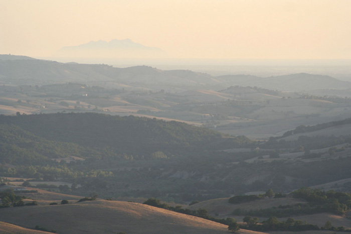
In some periods of the year, on the top of the mount we can get a grand panoramic view :can admire the
islands, the sea and inland, all the itineraries of our trekking.[1]
The itinerary
|
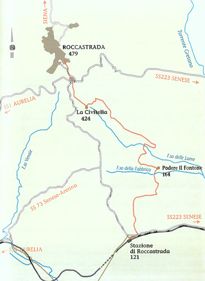 |
Map 1 Sticciano Roccastrada
|
|
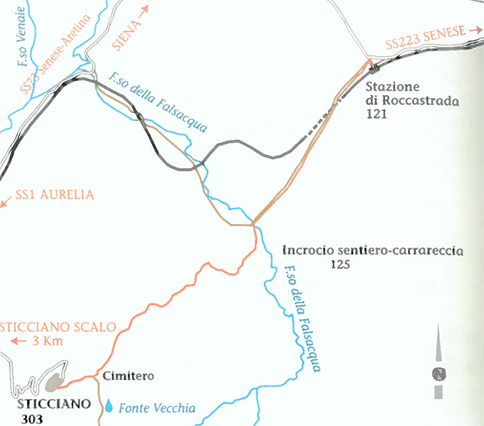
Map 2 Sticciano Roccastrada
|
|
|
|
| |
|


Trekking in and around Roccastrada
Sticciano - Roccastrada | 19 km, 5 hours
Roccastrada - Castello del Belagaio | 13,5 km, 4,5 hours
Castello del Belagaio - Torniella | 13 km, 4 hours
Torniella - Sassoforte - Roccatederighi | 20 km, 5 hours
Piloni - Sassoforte - Sassofortino - Roccatederighi | 16 km, 6 hours
Sassofortino - Montemassi | 13 km, 4,5 hours
Roccatederighi - Montemassi | 7 km, 2,5 hours
Hiking trails in the Val di Merse
1. Sentiero Iesa-Tocchi
2. Sentiero Iesa-Terme di Petriolo
3. Sentiero della Gola del Merse
4. Sentiero di San Galgano
5. Sentiero della Pietra
6. Sentiero Scalvaia-Valle del Farma
7. Sentiero Monticiano-Camerata
|
|

Trekking | Walking in Southern Tuscany
Analisi archeoastronomica della Pieve di Santa Mustiola a Sticciano | www.duepassinelmistero.com
Trekking in Toscana | Parks and nature reserves in Tuscany | Overview
Maps | Multigraphic – Tourist road map 1:50,000 - Maremma
Castello di Belagaio Coordinate: 43°4'44"N 11°13'8"E
|

Hidden secrets in Southern Tuscany | Podere Santa Pia
|
 |
Podere Santa Pia has been beautifully restored and overlooks a valley characterised by all the elements of the Tuscan landscape: vineyards, pastures, small forests, wheat fields, olive groves and downey oaks. On a clear day you can see as far as Corsica to the south.
|
| |
|
|
| |
|
|
|
|

[1] Source: Breve Guida Trekking Roccastrada | www.comune.roccastrada.gr.it |
|
|