
Monte Amiata |
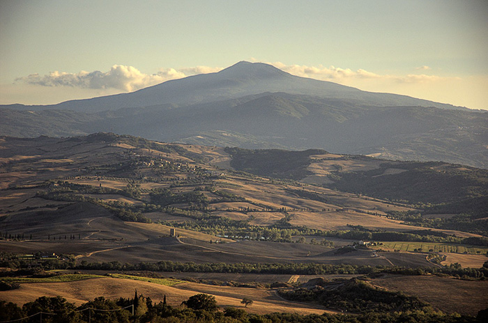
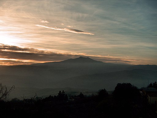
Monte Amiata is 1738 metres high and extends into the provinces of Siena and Grosseto, comprising the towns of Abbadia San Salvatore, Piancastagnaio, Castiglion d’Orcia and Radicofani. The well organised tourist reception structures of Monte Amiata make this a popular destination all year round and a perfect base from which to explore the marvels of Tuscany and nearby Umbria and Lazio. From a naturalistic point of view, this region offers ever changing scenery and colours, from snow in the winter to fresh temperatures in the summer.
A walk in the woods of Mount Amiata Monte Amiata - Amiata neve - Il portale ufficiale dell'Amiata invernale
|
||||
|
There are some examples of figurative art of the 1300’s, ancient architecture like the medieval castles, the abbeys of the Roman period (Abbadia San Salvatore, and Sant’Antimo), the Sforzesca di Castell’Azzara , the mansion Bourbon del Monte a Piancastagnaio, the renaissance and baroque churches, and the Peschiera at Santa Fiora.
|
||||
 |
||||
Image courtesy of the Image Science & Analysis Laboratory, NASA Johnson Space Center | The Gateway to Astronaut Photography of Earth | Enlarge view ISS018-E-35032.JPG |
||||
| The Olivastra Seggianese |
||||
The Olivastra Seggianese is a particularly hardy and wild cultivar, which grows on the slopes of Monte Amiata in secular olive groves ranging up to 600 meters over the sea level. The plant comes from a particularly robust rootstock: a mountain variety which is well able to resist the low winter temperatures, and this cazracteristic also acts as a natural deterrent to parasitic infestations. |
||||
| These ancient trees have had a huge impact on all the important civilizations of the Mediterranean for at least 4000 years - providing food, medicinal potions, and the most nourishing of oils. Today there are 500 different “cultivars” or varieties of olives. Italy is the world’s second largest producer of extra virgin olive oil, with 35 different geographical denominations recognized by the European Union. The "Consorzio Olio di Seggiano" was founded in 2002 under the spur of a group of local entrepreneurs dedicated to the production of the extra-virgin olive oil from the processing of the local cultivar, the Olivastra di Seggiano. The association was formed in order to improve its quality and its characteristics, by promoting the adherence to a code of conduct for local producers. |
|
|||
Galleria fotografica Monte Amiata
|
||||
 |
 |
 |
||
Monte Amiata
|
La Peschiera di Santa Fiora
|
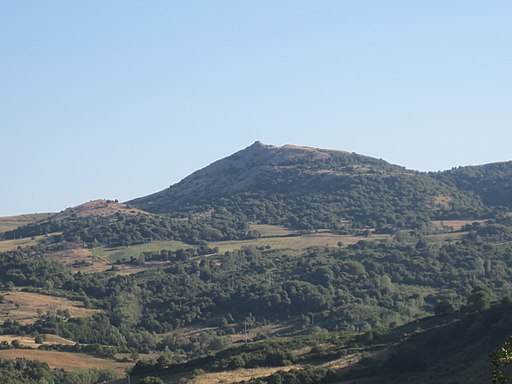
Monte Labbro
|
||
Abbazia di San Salvatore
|
||||
 |
 |
 |
||
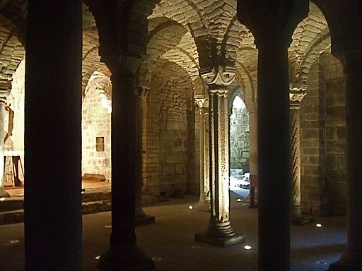
| Abbazia di San Salvatore | Abbazia San Salvatore di Monte Amiata, La cripta longobarda
|
|||
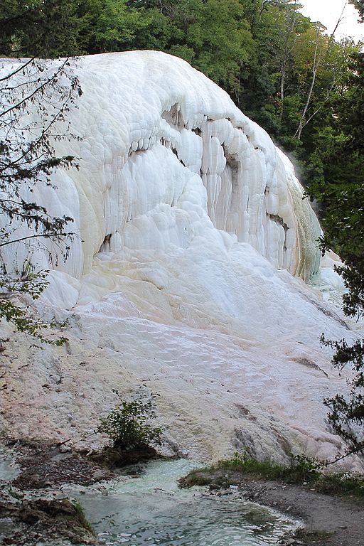
| Bagni San Filippo is located between the volcanic cone of the Monte Amiata and Val d'Orcia. There has been evidence of people, including famous ones like Lorenzo the Magnificent, coming here to relax at the spa since the late 12th century. It is common belief that the name of this town derives from St Filippo Benizi, the prior of the Florentine order of the Servants of Mary, who took refuge here in 1296 to avoid being elected pope at the conclave of Viterbo. Archaeological remains unearthed at Bagni San Filippo indicate that this was appreciated as a thermal bath location already under the Romans, from between the 1st and 2nd century AD. The thermal baths were restored during the 16th century by order of Cosimo de’ Medici and acquired considerable renown, even earning a mention in Machiavelli’s play La Mandragola. Terme San Filippo is one of the most spectacular thermal resort in Tuscany, known for its beautiful calcareous sediments made by the thermal water. The thermal waterfall whose 40 °C water is delightful year round, and especially invigorating in the winter. The waters, rich in sulphur, calcium and magnesium, renowned and used since the Middle Ages and Renaissance, cured famous people like Lorenzo il Magnifico. The sulphur waters of Bagni San Filippo have shaped the surrounding landscape, which is white with calcium deposits. In some points the deposits have created structures similar to waterfalls, the best known of which is named Balena Bianca, which looks out onto the Fosso Bianco – a small river that runs at the feet of Monte Amiata in a series of warm, white pools. Fraz. Bagni San Filippo, 23 - Com. Castiglione d'Orcia (SI)
|
||||
One of the loveliest small villages around San Quirico d’Orcia, Bagno Vignoni has been known for its waters since the Etruscans and later the Romans.
|
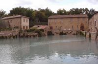 Bagno Vignoni |
|||

|
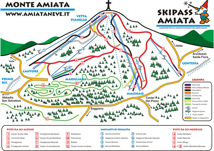 |
| In spring and summer, between 1000 and 1300 metres above sea level, Monte Amiata is ideal for trekking and mountain biking and the tourist itineraries are provided with a number of picnic areas. Among the most interesting excursions on the Monte Amiata are the Sentieri della Castagna – six itineraries for walkers and one for drivers. During the chestnut gathering season in autumn, from September 15th to November 15th, tourists are only allowed here accompanied by a guide. Some chestnut trees in this area are over 500 years old. Those who are fond of fine cooking will be able to enjoy the abundance of chestnuts in a variety of local dishes. Those who are more interested in tougher excursions either on horseback, trekking or by mountain bike, should not miss the Anello della Montagna itinerary that runs for 28 kilometres around the circumference of the old volcano. |
Arcidosso-Anello Amiata walk 10 Anello Amiata (Amiata's Ring) (AA and path 10 and 11 on the map) |
| A number of nature reserves have been instituted on Monte Amiata, such as the Parco Faunistico dell’Amiata, which is within the Riserva Naturale del Monte Labbro – not far from Arcidosso – and contains abundant fauna ranging from deer to wolves and a unique breed of wild donkey known as Amiatina. Walking in Tuscany | The Pigelleto Nature Reserve The Pigelleto Nature Reserve extends over a territory of 862 hectars between Siena and Grosseto. It is located in Piancastagnaio, a small town South-East from Monte Amiata in Tuscany. The Pigelleto Natural Reserve has been incorporated by the Regional Administration of Tuscany (Regione Toscana) in 1996. It used to host one of the most important quicksilver mines of Monte Amiata, today completely abandoned. The Environmental Education Centre La Direzione is inside the Reserve itself and includes the Visitors Centre, the Environmental Education Labs and facilities for visitors who wish to spend some time in peace and tranquillity. The Pigelleto Nature Reserve takes its name from the ancient term Pigello, with which the locals of Monte Amianta used to call the silver fir, the most common tree of this part of Tuscany. There are many excursion paths that run through the Nature Reserve of Pigelleto. Some paths are part of the marked trail n° 16 (Saragiolo - Miniera del Siele - Castell'Azzara) and n° 17 (Pod. La Roccaccia - Castell'Azzara) created by the Town of Monte Amiata. The Sentiero Natura (the Nature Trial) begins at Podere La Roccaccia and ends at the Environmental Education Centre La Direzione for a 2.5 km long walk inside the Reserve. Along the way you will find many information sighs about the animals and palnts. At times it coincides with the trial n° 16 that connects Saragolo with the Siele Mines. The Sentiero del Tasso (the Yew Trial) is part of Route n° 16 and is almost 2 km long. It takes you into the most beautiful and interesting part of the Reserve. This is why visitors must be accompanied by guides and rules are very stricted. During the trip you will see chstneut tress, beeches, silver firs and fern trees. There are also wet lands created by permant water sources. The Sentiero del Ponte (Bridge Trial) has been traced by the community of Monte Amiata and is 4 km long. It is inside the Reserve creating an 8 whch then coincides with the Nature Trial. Along hte way there is a break area in an old ruin (podere s. Ignazio) surrounded by beeches. The Sentiero Ciclabile (Cycling Trail) is part of the route n° 16 and n° 17 and is almost 6 km long. The asphalt roads are restricted to mountain bikes only. It runs through the woods of the Reserve and arrives at the cultivated lands that surround the Reserve. It goes up to Poggio Roccone and then down towards the Siele Mines.
|
From Vivo d’Orca to the hermitage and these spring of Vivo From Vivo d’Orcia we start downhill on Via dell’Eremo toward the white-fir forest of Vivo d’Orcia, one of the last remaining in Tuscany of this kind. Walking in Tuscany | Itineraries in Parco Faunistico en La Riserva naturale del Monte Labbro Walking in Tuscany | Semproniano - Roccalbegna - Triana - Roccalbegna - Semproniano Walking in La Riserva Naturale del Pigelleto | Saragiolo - Miniera del Siele - Castell'Azzara | Podere La Roccaccia - Castell'Azzara
|
Cycling in tuscany | Cicloturismo nella Maremma in Toscana | 35 cycling trials (It)
|
Enlarge map Monte Amiata |
Holiday homes in the Tuscan Maremma and Monte Amiata | Holiday home Podere Santa Pia
|
[1] Photo credits: riandreu | Flickr - Photo Sharing! |