 |
Balcone sulla Maremma
|
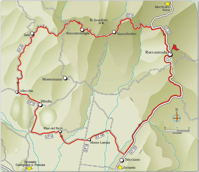
Cycling tours in Tuscany Maremma | A Balcony on Maremma - 57.2 km
|
BALCONE SULLA MAREMMA
Roccastrada - Sassofortino - Roccatederig hi - Tatti - Ribolla - Pian del Bichi - Roccastrada
|
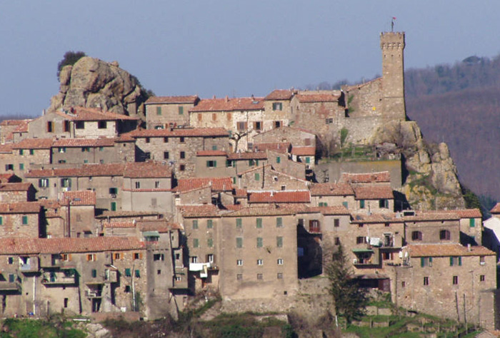 |
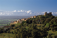
Roccarederighi, castle
|
|
||||
|
||||
 |
 |
|||
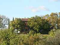
Podere Santa Pia |
Podere Santa Pia |
Scarlino | ||
|
|
||||
 |
 |
 |
||
| Sassofortino, panorama | Panorama di Gerfalco
|
Panorama Roccastrada | ||
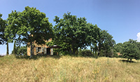
Castle of Monte Lattaia
|
||||
 |
||||
Panorama di Monte Lattaia Roccastrada [4]
|
||||
The Lattaia Castle rises up amongst lush natural surroundings in the territory of Roccastrada. Located on a hill overlooking the Bai creek, this castle was one of the main strongholds of the Aldobrandeschi family as far back as the 10th century. In the early years of the 1200s, it belonged to the Pannocchieschi family. It was contested by local families and was taken over by the City of Siena in 1262. Over the course of the 14th century, Siena managed the castle through the powerful Incontri and Salimbeni families. At the beginning of the 1400s, this area was completely considered part of the Republic of Siena until the 16th century, when it was no longer necessary for defence. Thus, the complex was converted into a farm. The remains of the ancient fortress include the circular layout of its ancient walls, which enclose a square bordered by a few buildings.
|
||||
Cycling in Tuscany | Cycling tours in Southern Tuscany Sito ufficiale di Musei di Maremma. Sito ufficiale della Cooperativa Colline Metallifere. Walking in Tuscany | Trekking in Tuscany in the Montioni Park, Etruscan Coast Trekking in Toscana | Itinerari. Sentieri escursionistici in Val di Merse | Trekking Roccastrada
|
||||
 |
 |
|
||
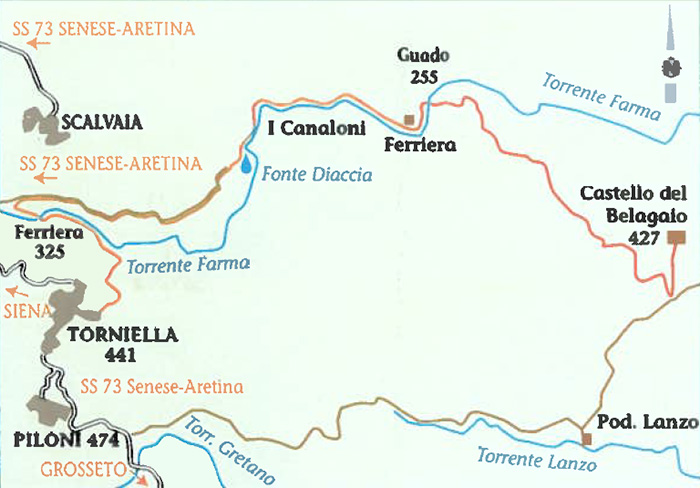
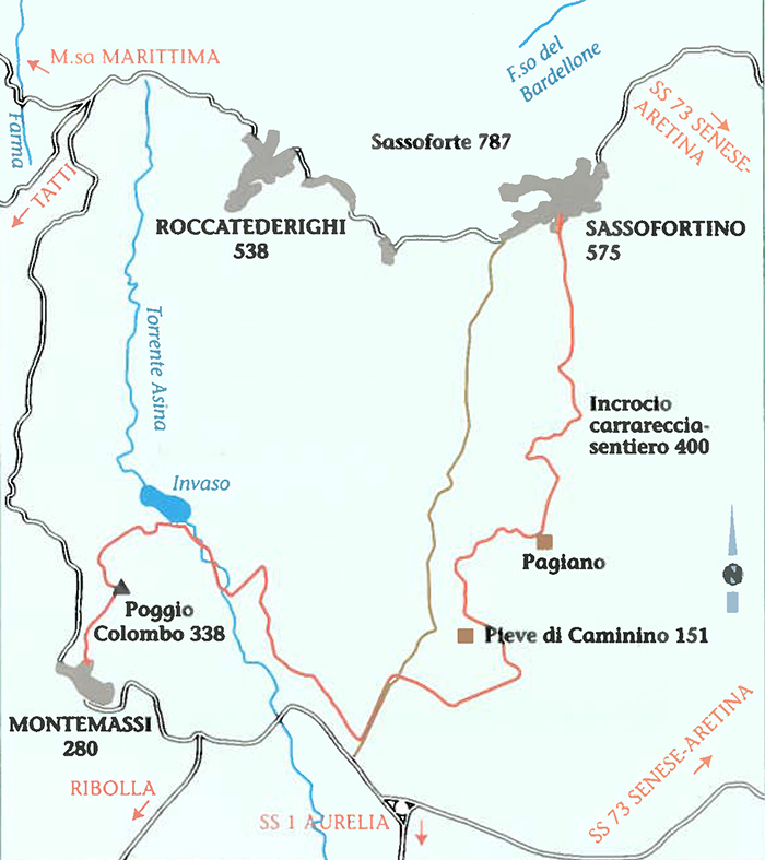
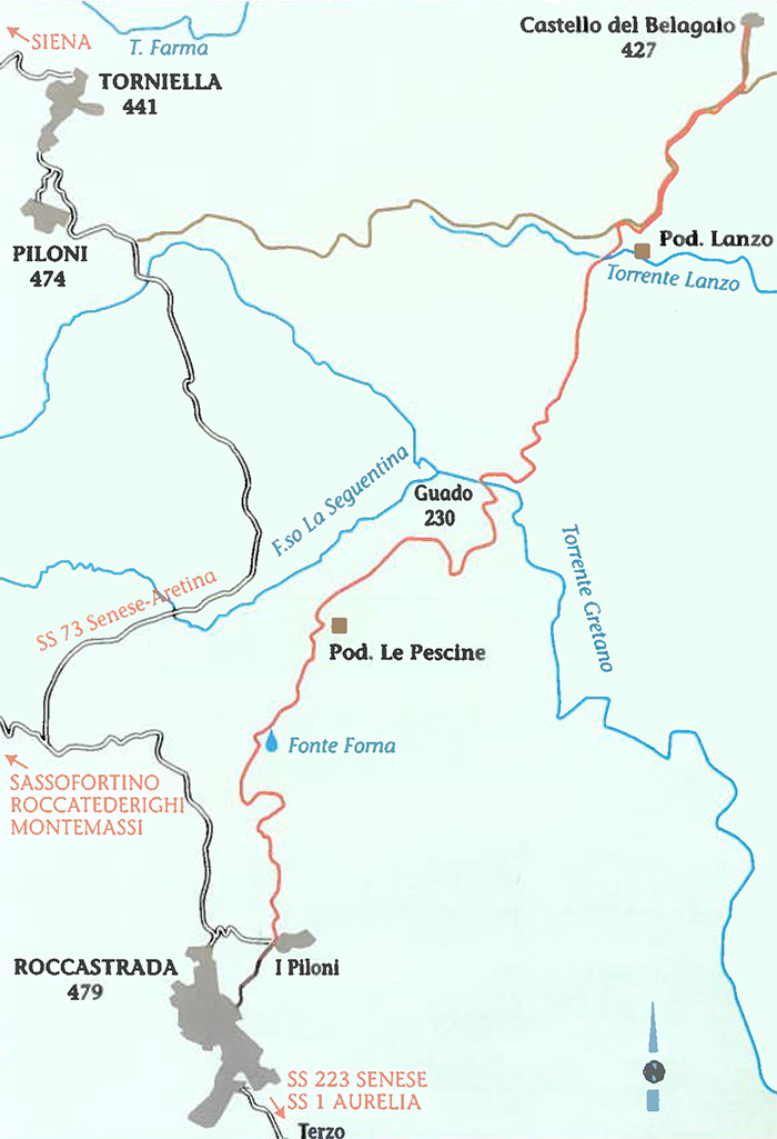
| Castello del Belagaio - Torniella | Roccatederighi - Montemassi | Sassofortino - Montemassi | ||
 |
|
 |
||
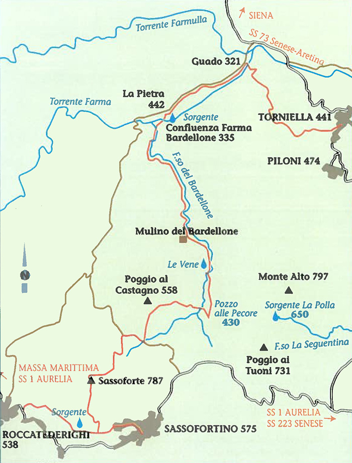
| Piloni - Sassoforte - Sassofortino - Roccatederighi | Torniella - Sassoforte - Roccatederighi | |||
Cycling in Tuscany | Journey into the Middle Ages (GR3)
|
||||
Wikimedia Commons contiene file multimediali su Monterotondo Marittimo.
|
||||