Abbadia San Salvatore

Abbey of Sant'Antimo

Albarese

Acquapendente


anghiari

Archipelago Toscano


Arcidosso


Arezzo


Asciano


Badia di Coltibuono


Bagni San Filippo

Bagno Vignoni

Barberino Val d'Elsa

Beaches

Bolsena Lake


Bomarzo

Brunello di Montalcino

Buenconvento

Campagnatico


Capalbio


Castel del Piano


Castelfiorentino

Castell'Azzara

Castellina in Chianti


Castelmuzio


Castelnuovo Bererdenga


Castiglioncello Bandini


Castiglione della Pescaia


Castiglione d'Orcia


Castiglion Fiorentino


Celleno


Certaldo


Chinaciano Terme


Chianti


Chiusi


Cinigiano


Città di Castello

CivitÀ di Bagnoregio


Colle Val d'Elsa


Cortona


Crete Senesi


Diaccia Botrona

Isola d'Elba

Firenze


Follonica


Gaiole in Chianti


Gavorrano

Gerfalco


Greve in Chianti


Grosseto


Lago Trasimeno


La Foce


Manciano


Maremma


Massa Marittima


Montagnola Senese


Montalcino


Monte Amiata


Monte Argentario

montecalvello

Montefalco


Montemassi


Montemerano


Monte Oliveto Maggiore


Montepulciano


Monteriggioni


Monticchiello


Monticiano


Orbetello


Orvieto


Paganico


Parco Naturale della Maremma


Perugia


Piancastagnaio


Pienza


Pisa


Pitigliano

Prato

Radda in Chianti


Roccalbegna


Roccastrada


San Bruzio


San Casciano dei Bagni


San Galgano


San Gimignano


San Giovanni d'Asso


San Quirico d'Orcia


Sansepolcro


Santa Fiora


Sant'Antimo


Sarteano


Saturnia


Scansano


Scarlino


Seggiano


Siena


Sinalunga


Sorano


Sovana


Sovicille

Talamone

Tarquinia


Tavernelle Val di Pesa


Torrita di Siena


Trequanda


Tuscania


Umbria


Val d'Elsa


Val di Merse


Val d'Orcia


Valle d'Ombrone


Vetulonia


Viterbo

Volterra


Walking in Tuscany
             
 
I T


Towards the Albegna Springs - 37.8 km


album Surroundings


Cycling in Tuscany | Towards the Albegna Springs


VERSO LE SORGENTI DELL’ALBEGNA
Arcidosso - Le Macchie - Bivio Buceto - Roccalbegna - Riserva del Pescinello - Bivio Monte Labbro - Località Aiole - Arcidosso


20.
Towards the Albegna Springs - 37.8 km


Arcidosso - km 0 Le Macchie- km 5.6 Bivio Buceto - km 10.3 Roccalbegna - km 20 Riserva del Pescinello - km 23 Bivio Monte Labbro - km 28.7 Località Aiole - km 34.6 Arcidosso - km 37.8

Starting point and arrival: Arcidosso
Distance in kilometres: 37.8 km
Difference in altitude: 1.050 m
Type of road: 22.3 km dirt track + 15.5 km tarred road
Bicycle: MTB
Difficulty: average - exacting

NOTES: The most demanding stretches are the two climbs to the slopes of Mount Labbro: the first one from the locality Serra a short while after the start and the second in the final stretch of the itinerary crossing the Nature Reserve of Pescinello. However, both are good to cycle on and do not present prohibitive slopes.

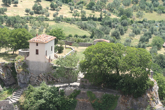
One starts from the roundabout in Arcidosso in the direction of Grosseto. After 250 metres, at the crossroads, one keeps to the left and takes the provincial road S.P.7 in the direction of Cinigiano - Grosseto cycling on a good to cycle on and not too steep slope. Reaching after 2 kilometres the locality Serra one turns left uphill and follows the road signs to Macchie, Zancona and the Wildlife Park. One cycles uphill on a tarred road for nearly 3.5 kilometres as far as the the locality Macchie (5.6) and when one reaches the street number 66 - on the right - one turns decidedly left cycling uphill and following the directions to a bar-restaurant; after 700 metres the dirt track begins.

One climbs gently and then after 4 kilometres one reaches a crossing where one turns right: one cycles without interruption uphill and after 400 metres one turns left. From this point a plain stretch (not too exacting ups and downs) begins, skirting a small valley on the left , the place of birth of the river Albegna.

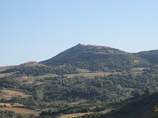
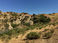
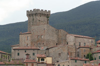
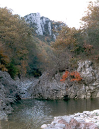
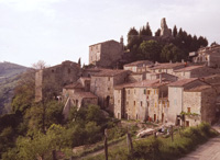
After about 3 kilometres, having reached a very panoramic site the road starts sloping decidedly down to Roccalbegna. Cycling downhill one enjoys a spectacular view of the Grosseto area of Maremma, the coast and Monte Argentario. At a crossroads with a trough: one turns left and nearly at once the ascent ending after 1.2 kilometres begins. At this point it is important to pay attention: on the right, looking down, a wooden stake is visible with a white and red aluminium plaque of the Grosseto province track marking. Here one leaves the road turning right (U-bend) and taking the path which in short becomes a not too good to cycle on track because of large stones: only those having a good technique are able to remain in the saddle. The technical stretch ends after 600 metres when one cycles steeply and smoothly downhill on the dirt track, as far as Roccalbegna (20) where one returns to the tarred S.P. 160. One turns left crossing the town (it deserves a visit) as far as the bridge over the Albegna where one starts climbing gently for about 3 kilometres as far as the signpost indicating the Natural Reserve of Pescinello (23). Here one turns left and takes to the dirt track smoothly climbing for 5.7 kilometres towards Mount Labbro (28.7).[1]


At the end of the climb one cycles on, simply taking the descending road and leaving Mount Labbro behind. One is now going to negotiate a 3 kilometres descent (one bypasses the detour on the left to the Wildlife Park) as far as a crossing where one leaves the dirt track to cycle on a tarred surface on the S.P. 160, turning left towards Arcidosso. After 1.5 kilometres exactly by the geothermal plant, visible on our right, one can get a fresh water supply on the other side, slightly under the road level, at the fount of the “Salacio”. One cycles downhill and then gently uphill as far as the locality Aiole (34.6) where one continues downhill as far as Arcidosso (37.8). [1]


Monte Labbro

View of Monte Labbro [2]


Pieve di Santa Maria ad Làmulas, Montelaterone    
Pieve di Santa Maria ad Làmulas, Montelaterone   La Rocca aldobrandesca di Arcidosso  

Eremo di David Lazzaretti or Torre Giurisdavidica, Riserva Naturale Monte Labbro


Monte Buceto   Monte Labbro   Castiglioncello Bandini, Calanchi in the valleybeween Podere Santa Pia, Federano and the torrent Rancida
Monte Buceto  

Monte Labbro


Castiglioncello Bandini, Calanchi in the valley beween Podere Santa Pia, Federano and the torrent Rancida


Turismo in Toscana | Case vacanza in Toscana | Podere Santa Pia


v
Podere Santa Pia
Podere Santa Pia
La Rocca Aldobrandesca di Arcidosso
         
   
ROCCALBEGNA, Il Cassero Senese  

Albegna


  Rocchette di Fazio

Walking and trekking in Tuscany

Da Roccalbegna a Rocchette di Fazio | Percorso a piedi, a cavallo e in bicicletta - 10 km

Trekking in Toscana | Da Roccalbegna alla Riserva Naturale del Pescinello

Trekking sul Monte Amiata: percorsi a piedi | Riserva Regionale Bosco Rocconi

Trekking in Toscana | Parco Faunistico del Monte Amiata : Il Sentiero Natura

Trekking in Toacana | Nell' Oasi WWF del Bosco Rocconi


Cycling in Tuscany | Cycling tours in Southern Tuscany


CENTRO VISITE DEL PARCO FAUNISTICO DEL MONTE AMIATA


Valley of the Albegna River (Valle dell’Albegna) between Roccalbegna and Rocchette di Fazi

Valley of the Albegna River (Valle dell’Albegna) between Roccalbegna and Rocchette di Fazio, Province of Grosseto, Tuscany, Italy. Seen from South to North, in the background Roccalbegna [3


[1] Source: Cicloturismo Toscana | www. maremmabike.it
[2] Foto Alienautic, licenziato in base ai termini della licenza Creative Commons Attribution-Share Alike 3.0 Unported.
[3] Foto LigaDue, licenziato in base ai termini della licenza Creative Commons Attribuzione-Condividi allo stesso modo 4.0 Internazionale