
 |
|
| I T | The Via Francigena in Tuscany |
La Via Francigena in Toscana |
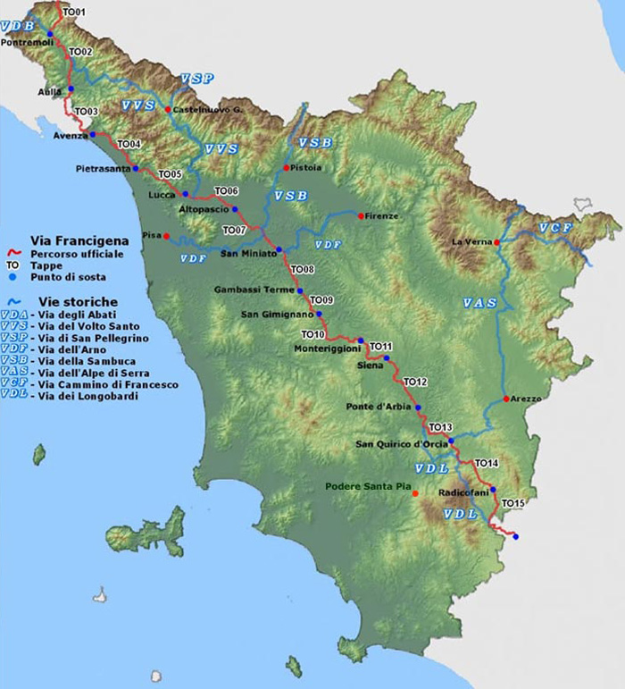
The Via Francigena is an ancient road between Rome and Canterbury, passing through England, France, Switzerland and Italy. In mediaeval times it was an important road and pilgrimage route. To pilgrims headed south, it was the Via Romea; to those headed north, the Via Francigena.
|
|
 |
|
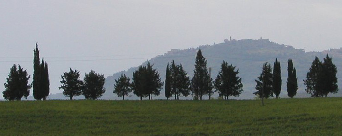
Montalcino surroundings |
|
| The first of these four areas begins at the Cisa Pass, the crossing point from the Region of Emilia Romagna into the Region of Tuscany, north of Pontremoli in the Appennine mountains, and follows the valley of the Magra river down to Aulla and Sarzana. This area is called Lunigiana, after the Roman port city of Luni, today an archaeological site, where marble was sent by ship to the rest of the world, as from the port of Carrara today. Sarzana, further inland, became an important intersection where the Roman road, called the Via Aurelia, and the Francigena met. This area is characterised by castles, walled mediaeval villages and isolated monasteries, constructed primarily of the gray limestone found locally. These places are never of great size and were built on the steep slopes of the mountains along the principal road and were easily defended. All around these locations there are woods, small tributaries and natural caves. |
|
| The second area begins at Sarzana and goes past Lucca to Altopascio. The principal characteristic of this sector is that the road hugs the foot of the Appuan alps and stays inland from the sea coast. The main towns one sees are Sarzana, Carrara, Massa and Pietrasanta, all in the marble working area, and Camaiore which is the only village mentioned by Sigeric after Luni. It is a flat area with some hills just before Lucca and was dotted with numerous churches, abbeys and hospices, the most famous being the Abbey of Camaiore, which goes back to the 8 C and where Sigeric certainly stayed. Lucca was already an important city at the time of Sigeric as it was the seat of the Duchy. Within the walled city of Lucca, the traveller today can visit many different kinds of museums and churches, particularly the Cathedral where there is a highly venerated crucifix said to show the real face of Christ. Lucca is also the starting point for trekking in the famous Garfagnana area where many foreign artists and musicians have settled. This sector ends at Altopascio which was, at the time of Sigeric, a very large centre for pilgrims, with places of refuge and hospices. |
|
| The third sector is the longest segment of the Francigena and runs from Altopascio, down to Fucecchio, and on to Sienna passing through Castelfiorentino, Certaldo, Poggibonsi, San Gimignano and Monteriggioni before it arrives in Sienna. Near Fucecchio, the road goes through very open and flat land that used to be swamp and which is still the crossing point of the Arno river, and there are rolling hills beginning near Castelfiorentino. All the cities were walled and the mediaeval atmosphere is still evoked by the narrow streets, gates and the buildings made from the local sandstone. The northern part of this sector passes small industries related to the tanning of leather and to the south through areas dedicated to the production of wheat, wine and olives. If one stops around Fucecchio, it is possible to make side trips to places such as Galleno, to see the longest reconstructed stretch of the original Via Francigena (1150 meters) or to Vinci the home of Leonardo, or Coiano mentioned by Sigeric, but today out of the way. The food is good and so is the local wine. After Fucecchio, one goes near San Miniato, a mediaeval village, through Castelfiorentino, Certaldo, Poggibonsi and San Gimignano. This last mentioned village is a very famous mediaeval walled city, today very active, famous for its 13 C towers and the Collegiata, where Ghirlandaio painted the chapel dedicated to the local saint, Santa Fina. Here again there are many places to visit - museums, churches and in the area some of the finest vineyards. Not far away there is Montelupo known for is pottery and ceramics. Next, we proceed to Colle Val d'Elsa, famous for its glass and crystal industry as well as for its historical past, and on to Badia a Isola and Monteriggioni, a splendid walled town. This is where one can again begin trekking and in fact there are remains of the via Francigena near here as well. |
|
| The fourth sector begins in Sienna and goes south to Abbadia San Salvatore. The geography is quite distinctive. The open rolling hills are planted with golden wheat, there are the gray crags of the Crete Senese and some of the most famous monasteries and great abbeys are located in this area. Sienna has always been an important political, economic and cultural area, and differs from the rest of the Tuscan cities in that it received many influences from France. From Sienna south, the Via Francigena closely follows the Via Cassia, another of the old roman roads. Visits to Isola d'Arbia, Buonconvento, Montalcino, the Abbey of Monte Oliveto Maggiore and San Quirico d'Orcia are all worthwhile. However the last two stops of Sigeric, Bagno Vignoni and Abbadia San Salvatore, are the most spectacular. Bagno Vignoni is where for centuries people have gone for health cures because the sulphur water baths. The Abbey of San Salvatore is the best conserved of the mediaeval villages with a great Abbey attached. It was already famous in the 8 C. |
|
On these pages we focus on the Via Francigena walk route from Passo to Cisa a Siena, and from Siena to Viterbo.
|
|
| The Via Francigena in the Siena Region | From Passo to Cisa a Siena |
|
Fom Passo della Cisa to Pontremoli - 19,4 km |
|
| From Pontremoli to Aulla - 32,9 km |
|
| From Aulla to Avenza - 32,4 km |
|
From Avenza to Pietrasanta - 27,8 km |
|
| From Pietrasanta to Lucca - 32,3 km |
|
| From Lucca to Altopascio - 17,8 km |
|
| From Altopascio to San Miniato - 23,5 km |
|
| From San Miniato to Gambassi Terme - 25,6 km |
|
From Gambassi Terme to San Gimignano |
|
|
Visualizza Tappa 09 in una mappa di dimensioni maggiori |
|
| From Gambassi Terme to San Gimignano - 13,4 km |
|
A short stage, however an interesting one for the beauty of the landscape along the Via Francigena. Exiting from the centre of Gambassi Termi, one goes towards the Luiano farm, passing through terrain cultivated with vineyards. Once past the farm, we encounter the bridge of the Madonna, on the Torrente dei Casciani which marks the confine between the provinces of Florence and Siena and the entrance to the municipality of San Gimignano. From here the route goes uphill past cultivated fields and beautiful cypresses until reaching Pancole, the site of a Marian sanctuary and a place for refilling water. The route involves going through the underground passage of the large religious structure. Shortly after, one can already glimpse the multi-towered profile of San Gimignano. But before reaching the town we encounter the charming Romanesque parish church of S. Maria a Cellole, completed in 1238, as recorded in an inscription to the side of the portal. From the church, passing the houses of Sferracavalli, one can take a brief detour to visit an Etruscan necropolis with well-preserved hypogeous room tombs that date between the 4th and 1st century BC. There is no rest point along the route. From Gambassi Terme to San Gimignano - 13,4 kmDa Gambassi Terme a San Gimignano - 13,4 km |
|
From San Gimignano to Monteriggioni |
|
|
|
|
View Tappa 10 in a larger dimension |
|
| From San Gimignano to Monteriggioni - 29,8 km Total length (km): 29.8 Travel time on foot (h: min): 7.30 Paved roads: 19% Dirt roads and driveways: 70% Mule tracks and trails: 12% Getting to the starting point: FS Empoli-Siena Railway Line, Poggibonsi station; bus line 133 for S. Gimignano |
|
| This 29.8 km leg begins in San Gimignano and takes in about 7 hours to complete. It is one of the most beautiful legs of the Via Francigena, and after the frst section of the path, you begin to walk up and down in the valley of the Foci river, near Molino d'Aiano. A path leads upward to the Romanesque church of Santa Maria a Coneo. Then you cross the bridge on the hilltop to reach the Romanesque church of San Martino di Strove. Then you go to the Abbey of Island, before catching a sight of Monteriggioni, with its unmistakable ring of walls and towers that dominate the surrounding hills. From San Gimignano to Monteriggioni - 29,5 km Da San Gimignano a Monteriggioni - 29,5 km |
|
From Monteriggioni to Siena |
|
ViewTappa 11 in a larger dimension |
|
| From Monteriggioni to Siena - 20,5 km |
|
| Departure: Monteriggioni, Piazza Roma Arrival: Siena, Piazza del Campo Getting to the starting point: FS Empoli-Siena Line, Castellina Scalo station |
|
| This 20.5 km leg begins in Monteriggioni and takes in about 6 hours to complete. Leave Monteriggioni and walk along the road in the Sienese hills to the medieval village of Cerbaia. It runs through the woods up to the Castle of Chiocciola and the Castle of Villa, before descending down toward Pian del Lago. Then cross the Renai woods before arriving at Porta Camollia, the traditional Via Francigena entrance to Siena. In the city, walk down Banchi di Sopra and then up to the end of this leg in Piazza del Campo, the Duomo and then the hospital of Santa Maria della Scala. From Monteriggioni to Siena - 20,5 km Da Monteriggioni a Siena - 20,5 km |
|
| The Via Francigena in the Siena Region | From Siena to Viterbo | |
La Via Francigena | From Siena to Ponte d'Arbia |
|
View Tappa 12 in a larger dimension |
|
La Via Francigena | From Siena to Ponte d'Arbia - 28.5 km Departure: Siena, Piazza del Campo Arrival: Ponte D'Arbia, Centro Cresti Length: 28.5 km ype of travel: On foot, by mountain bike Travel time on foot (h: min): 6.20 Getting to the starting point: Empoli-Siena-Grosseto and Siena-Chiusi railway lines, Siena or Monteroni d'Arbia station |
|
The 28.5 km leg of the Via Francigena begins in Siena and takes less than 7 hours. A challenging course along the roads of the Val d'Arbia, with rolling landscapes and views on the skyline of the city of Siena, leading to the Grancia di Cuna, an ancient fortified farm that was owned by the Santa Maria della Scala hospice.
|
|
Da Ponte d'Arbia a San Quirico d'Orcia |
|
| |
|
Visualizza Tappa 13 in una mappa di dimensioni maggiori |
|
| 13 | La Via Francigena | From Ponte d'Arbia to San Quirico d'Orcia - 27,47 km |
Departure: Ponte D'Arbia, Centro Cresti How to get to the starting point: |
|
From Ponte d'Arbia you cross the river and the Siena-Buonconvento railway line, you walk along the tracks, arriving at the parish church of Sant'Innocenzo a Piana, documented as early as the 11th century and fortified in the early 15th century. The parish church of Sant'Innocenza a Piana is a sacred building located in Piana a Buonconvento. Documented since 1081, it appears as a fortified organism, with the typical features of Sienese military architecture of the 13th-14th century. Inside you can see traces of a 14th-century fresco with San Cristoforo and another fresco, also fragmentary, where the figure of the Blessed Franco da Grotti remains. You continue on a dirt road in a southerly direction and, after crossing the Arbia river, you enter the medieval village of Buonconvento, a typical 'street-city' along the Via Francigena, remembered because in 1313 the German emperor Henry VII died there. |
|
From San Quirico d'Orcia to Radicofani |
|
Visualizza Tappa 14 in una mappa di dimensioni maggiori |
|
| 14 |
La Via Francigena | From San Quirico d'Orcia to Radicofani - 32,7 km Departure: S. Quirico d'Orcia, Collegiata How to get to the starting point: |
| Leaving San Quirico d'Orcia, take a road towards Ripa d'Orcia, skirting the hill on an itinerary that becomes a dirt road. Then you descend towards Vignoni, cross the village characterized by the central fortress, continue downhill on a dirt road and arrive at Bagno Vignoni, a spa already active in Roman times and frequented in the Renaissance by Lorenzo the Magnificent. Continue downhill on the carriage road until you return to the Via Cassia, cross the Orcia river and shortly after you climb towards the Rocca d'Orcia, skirting the village of Castiglione d'Orcia, over which the Aldobrandesco castle stands. Going back down towards the valley, you travel through a hilly environment with cultivated fields on the sides and some farms. The road continues along the Via Cassia, passing through the Briccole, an ancient hospital and station mentioned by Sigeric as Abricula. After crossing the Formone stream, you go up the ridge on an asphalt road, passing by the Le Conie farmhouses, up to the Radicofani fortress.[2] Water and refreshment points in Bagno Vignoni and Gallina (bar 500 m from the route, on the Via Cassia). La Via Francigena | Da San Quirico d'Orcia a Radicofani -32,7 km |
|
From Radicofani to Acquapendente |
|
|
|
|
Visualizza Tappa 15 in una mappa di dimensioni maggiori |
|
| 15 | La Via Francigena | Da Radicofani a Acquapendente - 31,8 km Radicofani, La Novella (Km 8), Ponte Rigo (Km 10,4), Centeno (Km 15,8) Acquapendente (Km 23,8). |
Departure: Radicofani, church of San Pietro How to get to the starting point: |
|
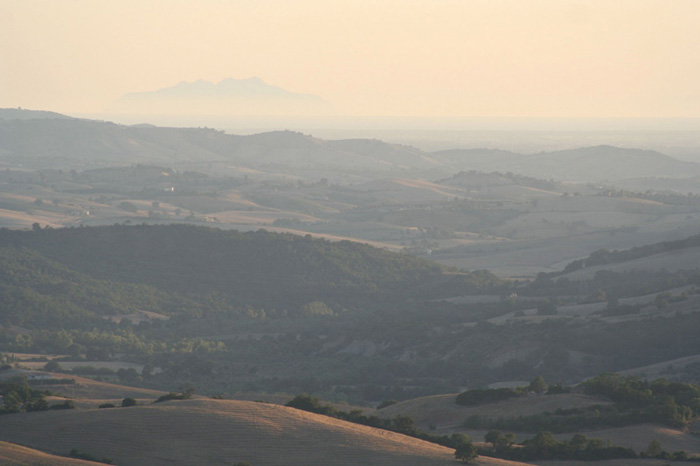
The descent from Radicofani along the old Cassia is one of the most beautiful and exciting stretches of the entire Via Francigena: all around hills as far as the eye can see and Mount Amiata, with the Rocca behind. |
|
 |
|
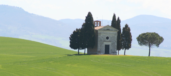
La cappella della Madonna di Vitaleta between San Quirico d'Orcia and Pienza The chapel of Santa Maria di Vitaleta must be one of the most photographed places in all of Tuscany |
|
| The Via Francigena | Walk Route |
||||
| Via Francigena – Walk Route The road books, the maps, the Google Earth and the GPS trails for the walk route of the Via Francigena. A practical and utile guidebook for the numerous Europeans who choose to experience Europe following the route and discovering the paths that make up the historical stages. The Via Francigena itinerary is completely traced by GPS and fully described on maps and road books. All the materials are available on www.francigenalibrari.beniculturali.it/news1_en.html |
||||
| (See the complete Route on Google Earth) |
||||
| The Via Francigena | Links |
||||
| Reasoned list of useful cultural and tourist links on the ancient faith ways. |
||||
| Guide books |
||||
| La Via Francigena. Vademecum dal Gran San Bernardo a Roma Way from the Grand St-Bernard to Rome. |
||||
| Paul Chinn and Babette Gallard, The Lightfoot Guide to the Via Francigena, Pilgrimage Publications, 2009. In 3 volumes, Canterbury to Besançon; Besançon to Vercelli; and Vercelli to Rome. Available through our Bookshop. Mainly inteneded for cyclists, but it gives good route-finding information with GPS references and details of accommodation and services. | ||||
| The best guide book to the Via Francigena in Italy is written in Italian. Guida alla Via Francigena: 900 chilometri a piedi sulle strade del pellegrinaggio verso Roma, by Monica d'Atti and Franco Cinti. (Supplemento al numero 132, aprile 2006, di "Terra di Mezzo." Piazza Napoli 30/6, 20146 Milano.) ISBN: 88-8938-565-0. Concise route description of the section from the Great Saint Bernard Pass to Rome, with details of acommodation and services. Its maps are incredibly detailed, there are many photos and much information can extracted even if you can't read Italian. There is a separate set of three maps with distances and GPS settings from the same publisher. ISBN 9788889385609 |
||||
| La Via Francigena Guida per il pellegrinaggio a piedi dal Gran San Bernado a Roma, Luciano Pisoni & Aldo Galli, ADLE Edizioni, Padova, 2004. ISBN: 88-8401-046-2. Guide to the Italian section of the route comprising a book and 28 laminated A4 size maps, with walking instructions and accommodation details on the back of each one. |
||||
| Maps |
||||
| Monica D’Atti & Franco Cinti, La Via Francigena. Cartografia e GPS. Dal Monginevro a Roma lungo l’itinerario storico, Milan: Terre di Mezzo Editore, 2007. ISBN: 978-88-8985-60-9, 22€.
3 large sheets of maps in a set, covering the 800km from the Monginevro Pass over the Alps to Rome at a scale of 1:30.000, i.e. nearly two and a half inches to the mile. In full colour there are 40 detailed maps covering all the stages of the journey, with the walkers’ route traced on them, height profiles, types of roads/paths used and complete GPS data. Designed initially to accompany the authors’ own guide book (see above) the only drawback (at present) is that those wishing to follow the “Sigeric route” (i.e. cross the Alps via the Great St. Bernard Pass) will have to wait till Vercelli (150km into the Italian part of the route) before they can use them. |
||||
| TOPOFRANCIGENA A.Canterbury-Gd St-Bernard 1000km: 40 geo-cultural pocket-sized colour map-cards 150g prepared by Adelaide Trezzini with Giovanni Caselli providing the graphics View TOPOFRANCIGENA dal Gran San Bernardo a Roma (900km) was published in 2005. The Topofrancigena is a set of maps (again in two parts Canterbury to St Bernard Pass published - Italian 2005) of the route. The Canterbury to St Bernard Pass section consists of 40 pages in full colour, with alternative routes, very loosely bound so old pages can be discarded. The maps show town or villages with accommodation and churches and historic sights. |
||||
Walking Pilgrim, old pilgrim routes in W Europe | Via Francigena in Italy WMS/APIs for Maps: Italy | Portale Cartografico Nazionale; includes 1:250,000, 1:100,000 and 1:25,000 topo maps (beware! many of the sheets are very old) |
||||
|
||||
 |
||||
Podere Santa Pia, splendido paradiso con vista panoramica sulla Maremma Toscana, nel silenzio della natura |
||||