 |
|
| I T | Tombolo di Feliglia
|
Tombola di Feniglia | La Riserva naturale Duna Feniglia
|
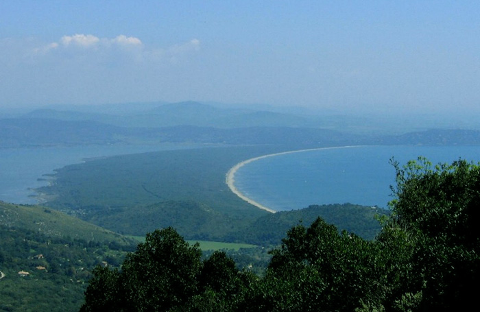
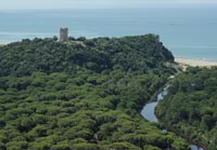
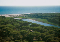
La Feniglia, situata nel comune di Orbetello, in provincia di Grosseto, è un tombolo che collega la collina di Ansedonia a oriente e il Monte Argentario a occidente. Si sviluppa per circa 6 km di lunghezza per una superficie totale di 474 ettari.
|
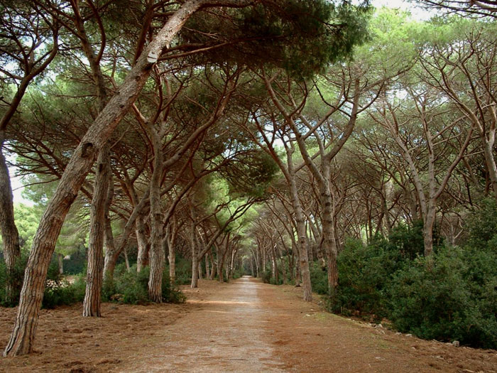
Acceso Storia Nel 1610 il celeberrimo pittore Michelangelo Merisi da Caravaggio, detto il Caravaggio, giunse da Napoli sbarcando prima a Palo e poi a Porto Ercole; in fuga per problemi con la giustizia, egli si rifugiò tra i malsani acquitrini e i tomboli di cespugli della Feniglia e vi trovò la morte, sopravvenuta per stenti e febbri malariche. Una stele commemorativa è stata posta, su iniziativa della Società Storica Maremmana, poco distante dalla odierna postazione del Corpo Forestale, luogo del presunto ritrovamento del moribondo Caravaggio. Fino a tutto il 1700, la Feniglia era completamente ricoperta di boschi con prevalenza delle specie tipiche della macchia mediterranea. Il Comune di Orbetello nel 1804, a quel tempo proprietario dei terreni, procedette con la vendita della Feniglia a privati che ne avviarono l'utilizzo intensivo e spropositato come sede di pascoli e fonte di legname. Tale disordinato sfruttamento del territorio portò alla deforestazione: la sparizione della vegetazione lasciò la duna scoperta e priva di ripari montuosi, dando inizio un veloce processo di erosione soprattutto a causa del clima, dei venti e dell'azione antropica. Sotto l'azione del libeccio, le sabbie cominciarono a muoversi verso sud-est, cioè dal mare verso la laguna che iniziò ad interrarsi con la formazione di specchi d'acqua e acquitrini, che crearono condizioni favorevoli alla malaria. Al tempo, la laguna era risorsa primaria per Orbetello, grazie alle sue risorse per l'industria della pesca. Le condizioni favorevoli alla malaria, inoltre, preoccuparono fortemente l'amministrazione comunale. Un primo rimedio consistette nella costruzione di canali di sbocco per la laguna verso il mare. Nel 1910 si intervenne con espropri, la Feniglia divenne Demanio Forestale e si procedette al rimboschimento del territorio: furono seminati diverse specie: il pino marittimo, il pino domestico e alcune specie erbacee adatte. Tali interventi hanno portato, nell'arco dei successivi 50 anni, alla creazione di un bosco di circa 460 ettari di estensione, di cui 320 ettari di pineta di pino domestico e 124 di pineta di protezione, mentre la rimanenza è costituita da latifoglie e piccoli terreni ancora da rimboschire. Nel 1971, su Decreto del Ministero dell'Agricoltura e delle Foreste, la duna Feniglia fu dichiarata Riserva Forestale di Protezione in virtù delle importanti funzioni che essa svolge. |
|
| Pineta di Feniglia, una delle passeggiate preferite, |
|
||
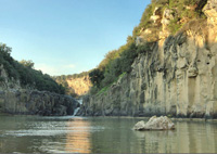
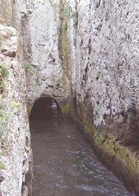
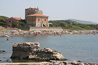
| Tagliata of Ansedonia |
||
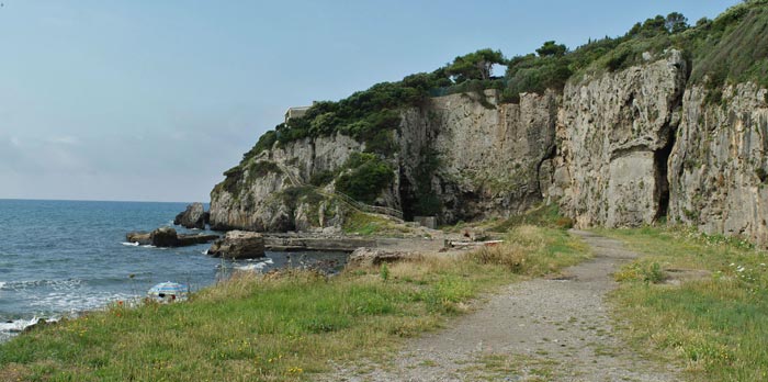
At the foot of the hill occupied by the Roman colony of Cosa (273 B.C.), a port was built and equipped with impressive infrastructures, in part still visible. To prevent the port from silting up and to guarantee a constant exchange of water, a large fissure of the promontory of Ansedonia, the so-called Spacco della Regina (queen’s cleft), was equipped with mobile bulkheads, the recesses of which are still visible in the rock. The wooden doors were opened according to the season, in order to let water in or out of the dock and thus avoid it from stagnating and debris from accumulating.
|
|
|
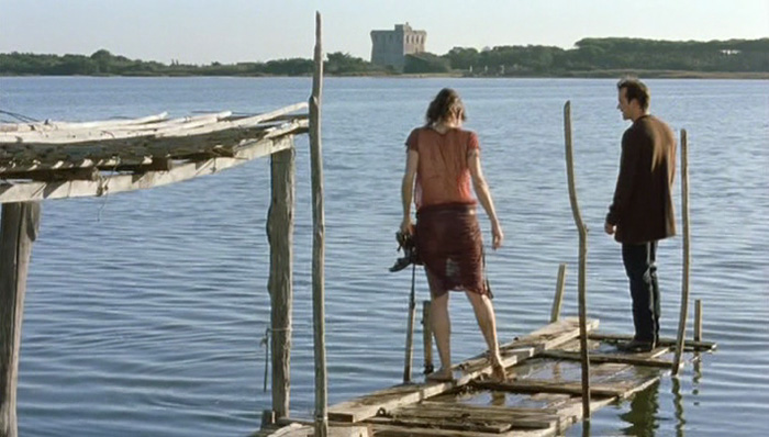
The cliffs, heated by the Maremma sun, connect the long beach of Feniglia and the Taglia Etrusca, a magnificent channel cut through the rock by the Romans, designed to ensure the flux and reflux of water into the ancient port.
|
||
Walking in Tuscany | Tombola di Feniglia, la Duna di Feniglia |
||
Ansedonia
|
 |
|
Anello Tombola di Feniglia, la Riserva naturale Duna Feniglia
|
||
Entrance Riserva naturale Duna Feniglia |
||
The Ramsar Convention on Wetlands
www.wwf.it | Riserva Naturale dello Stato Lago di Burano (it)
|
||
Riserva Naturale della Laguna di Orbetello (Grosseto) | Environment, Flora and Fauna in the Orbetello Lagoon Nature Reserve Orbetello Laguna di Ponente Orbetello |
|
|
[1] Source: Parco degli Etruschi | Cosa: when the Romans conquered Etruria [2] Julian Budden, Puccini: His Life And Works, New York: Oxford University Press, 2002.
| ||

|
||||
 |
 |
 |
||
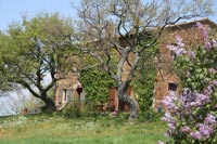
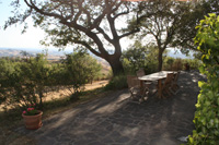
Podere Santa Pia |
Podere Santa Pia |
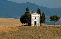
Madonna di Vitaleta Chapel, San Quirico d'Orcia |
||
 |
 |
|||
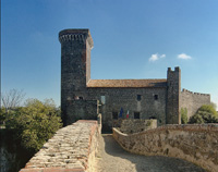
Vulci, Castello della Badia |
The oasis Vulci extends along the river Fiora, where a water fall has originated a small lake, lago Pellicone
|
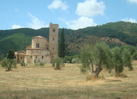
Abbey of Sant'Antimo |
||
 |
 |
 |
||
| Orbetello e Tombolo di Feniglia | The most famous part of the Maremma is the Parco Naturale della Maremma, otherwise known as the Parco dell'Uccellina |
Principina a Mare The Ombrone River located along the coast of Maremma Grossetana, where it flows into the Tyrrhenian Sea in Principina a Mare. |
||
|
||||
 |
||||
Regina Nemni and Christopher Buchholz in Michelangelo Antonion's Il filo pericoloso delle cose |
||||