| |
|
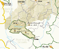
The Gate to Terre di Siena
Montieri - Bivio Gerfa lco - Pian dei Muci ni - Prata - Gabellino - Montieri
3 - The Gate to Terre di Siena 37 km
Montieri - km o - Bivio Gerfalco - km 3.5 - Pian dei Mucini - km 16.5 - Prata - km 22.5 - Gabellino - km 27.3 - Montieri - km 37
Punto di partenza e arrivo: Montieri
Lunghezza: 37 km
Dislivello: 550 m
Tipo di strada: asfalto
Bicicletta: strada o tuttoterreno
Difficoltà: medio - facile
Departure/arrival point: Montieri
Difficulty: Easy to medium
Road type: Asphalt
Length: 37 km
Slope: 550 m
NOTE: This trail’s only challenging stretch runs uphill for 5.5 kilometers; it’s toward the end of the itinerary as you proceed toward Montieri. Because the trail is relatively short and lacking other significant challenges, it is considered suitable for cyclists who are not in top shape.
A few minutes from the village of Boccheggiano, you can visit, by appointment, the enchanted Garden of Sounds.
From the center of Montieri, you’ll reach an uphill ramp that follows the right side of the town’s Palazzo Comunale and reaches a trail leading to the S.P. 11 ‘Pavone’, as it veers to the left toward Gerfalco. To the right, you’ll see wonderful views of the forests surrounding Gerfalco and the knolls overlooking Cornate’s Nature Reserve. After 3.5 km, we suggest cyclists take a detour toward Gerfalco (4km round-trip). The itinerary continues along the S.P. 11; it’s a gentle sloping trek downhill until you reach the SR 439 junction, where you take a left toward Massa Marittima. Expect an additional 6km-trek toward the Pian dei Mucini, until you reach a junction by the same name, where you’ll find a tavern-bar.
From Pian dei Muci continue along the S.P. 162, toward Prata. You’ll be cycling uphill for about 6 kilometers until you reach the viaduct the runs near Borgo di Prato (it will be visible on your left). Continue along the same road until you come upon the Gabellino district (27.5). From here, you can either veer right and reach the town of Boccheggiano (2 km and 190 m slope) or continue along for another 3.7 km until arriving at a fork in the road leading to Montieri (31). Go left here. Once you’ve passed the bridge that crosses the Merse River, ride along the S.P.5 and continue going uphill toward Montieri. (5.7km and 273 meters slope). This uphill journey requires effort but it does not present particular challenges. You’ll enjoy this path amidst oak and chestnut trees, as it leads toward the hamlet (37).
|
|
|
|
| |
|
|
|
 |
|
 |
|
|
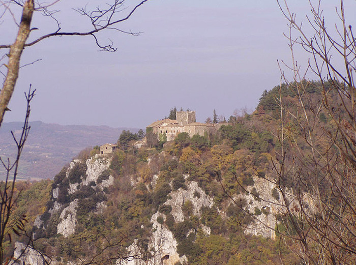
Itinerary from Castello di Fosini to Gerfalco
|
|
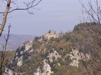
Castello di Fosini |
| |
|
|
|
|


Podere Santa Pia
Turismo in Toscana | Case vacanza in Toscana | Podere Santa Pia
|
| |
|
|
|
|
|
|
 |
Podere Santa Pia |
|
Podere Santa Pia |
|
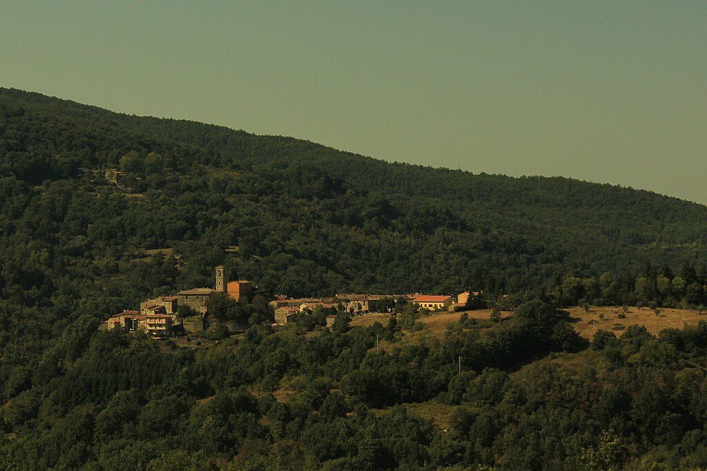
Prata
|
 |
|
 |
|
 |
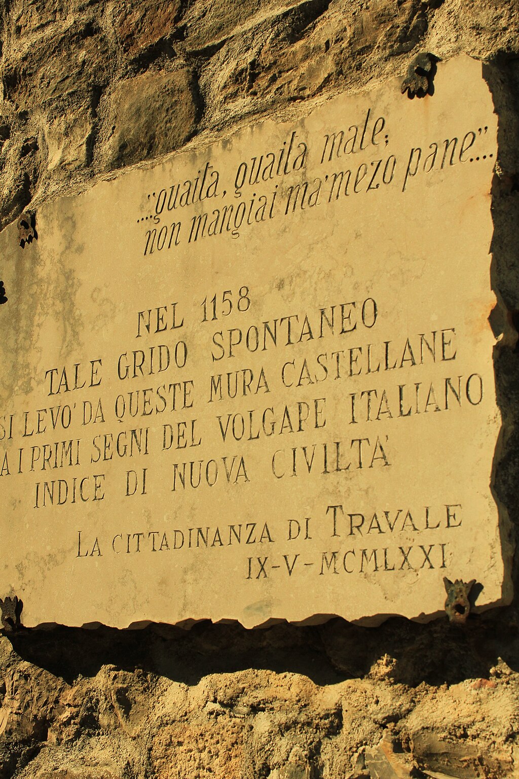
Travale inscriptions[3]
|
|
Teatro di Boccheggiano [3] |
|
Panorama di Travale [3] |
| Le Colline Metallifere |
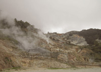
Le Colline Metallifere costituiscono il principale e più esteso sistema collinare e montuoso dell'Antiappennino Toscano. Si estendono nella parte centro-occidentale della Toscana, interessando ben quattro province, la parte sud-orientale della provincia di Livorno, la parte meridionale della provincia di Pisa, la parte sud-occidentale della provincia di Siena e la parte nord-occidentale della provincia di Grosseto chiamata anche Alta Maremma. Il territorio, se si eccettuano le vette del Poggio di Montieri e delle Cornate di Gerfalco che superano i 1000 metri di quota, risulta prevalentemente collinare, estremamente ricco nel sottosuolo di risorse minerarie di vario tipo e localmente, tra la provincia di Pisa e quella di Grosseto, sono presenti anche fonti di energia geotermica che si manifestano sotto forma di soffioni boraciferi, autentici geyser di vapore.
Già al tempo degli Etruschi, le Colline Metallifere erano conosciute e sfruttate per i giacimenti di minerali ferrosi, pirite, calcopirite, allume, antimonio, calamina, blenda e galena; l'attività estrattiva continuò sempre incessante e raggiunse il suo picco tra la seconda metà del XIX secolo ed il secondo dopoguerra quando vennero sfruttati soprattutto i giacimenti di lignite (miniere Ribolla e Casteani), declinando poi rapidamente.
|

|
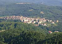
Panorama di Gerfalco
|
Tuscan Mining Geopark, Technology and archaeology within an extraordinary nature
|
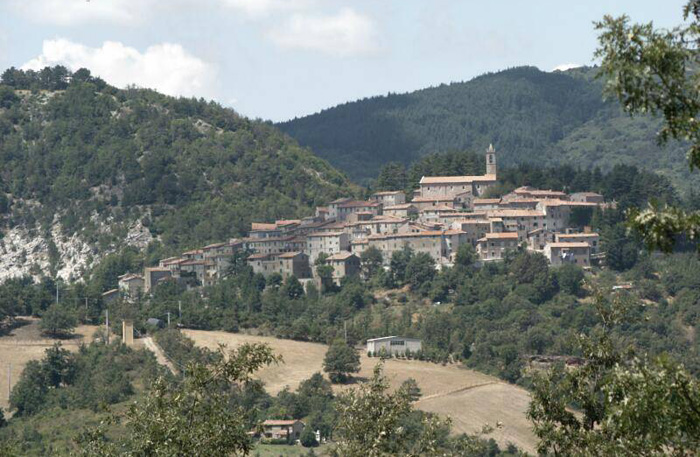
Montieri
Paul Fuchs Garden of Sounds
The Garden of Sounds is an artistic park located in a rural area near Boccheggiano, in the municipal territory of Montieri (GR).
The park-museum, which covers an area of about 2 ha, houses a collection of artist Paul Fuchs sculptures, made of materials such as copper, iron, bronze, wood and the stone. The works have found a natural place in the meadows, among the trees of the wood and the area overlooking the house of the sculptor.
Paul Fuchs (born 1936, in Munich) is best known as half of the husband and wife fusion duo Anima. With Anima he expanded his instrumental repertoire by inventing a whole range of bizarre instruments, like the notorious Fuchshorn, and increasingly a unique range of sound sculptures and percussion instruments. [4]
The name Garden of Sounds comes from the sound waves that are emitted by the sculptures, which tend to fluctuate in proportion to the intensity of the wind. The sound effects are made possible by the particular location and composition of the works, specially designed by the sculptor to create evocative musical effects, within an artistic context and nature of particular value.
The art park is open to visitors by appointment.
How to get there
You arrive at the Garden of the sounds through several directions, namely: from the main road that connects Grosseto Roccastrada; the Siena-Grosseto exit Civitella Marittima; Ss.Aurelia from Livorno-Roma Braccagni exit, then continuing for Roccatederighi. Each of these backgrounds implies, however, continuing to Meleta in the direction of Massa Marittima, after traveling several kilometers of dirt road in a forest, you must leave the car about 700 meters from the farmhouse of Fuchs continuing on foot.
Info and reservation i: 0566.998221 – www.paulfuchs.com
|
 |
Colline Metallifere seen from Campiglia Marittima [2]
|
 |
Tutto sul Comune di Montieri | www.turismomontieri.it/en/
Cycling - Costa degli Etruschi | www.costadeglietruschi.it | Percorsi cicloturistici
Cycling in Tuscany | Cycling tours in Southern Tuscany
www.turismoinmaremma.it | Colline Metallifere | Reiseführer und interessante Informationen über das Eisenerzgebiet | pdf Download
Sito ufficiale di Musei di Maremma.
Sito ufficiale della Cooperativa Colline Metallifere.
Parco Tecnologico Archeologico delle Colline Metallifere Grossetane, parcocollinemetallifere.it.
Il giardino dei Suoni, irre.toscana.it.
Walking in Tuscany | Trekking in Tuscany in the Montioni Park, Etruscan Coast
|
|
 |

|
|
Le Roste (Comune di Monieri, Grosseto). L'area delle Roste, lungo il fiume Merse e visibile dalla strada che collega Massa Marittima con Siena, raccoglie i resti delle lavorazioni del rame a partire dalla fine del XIX, inizi del XX secolo, avvenute con il metodo Conedera.[3]
|
 |
|
 |
|
|
Chiesa di San Michele e San Silvestro con Oratorio della Compagnia a Travale, Comune Montieri [3]
|
|
Palazzo dei Marchesi Papi Matii in Montieri, Grosseto [3] |
|
Panorama di Travale [1] |

Biking tour in Tuscany Maremma | Unspoiled Nature and Stone Villages | Montieri | Natura intatta e borghi di pietra
Montieri - Gerfalco - Lame - Travale - Montie
Biking tour in Tuscany Maremma | The Metalliferous Hills 73,7 km | Le colline del Metallo
Massa Marittima - Monterotondo - Montioni - Fattoria Marsiliana - Massa Marittima

The Colline Metallifere (“Metalliferous Hills”) in the Grosseto area, and the area of Montieri in particular, represent a highly unusual territorial context, full of important mining and metallurgical evidence from the pre-industrial era; alongside these the territory also displays important signs of more recent mining history. The routes suggested here will guide you to the discovery of some of these features: from the most remote traces of the Buca delle Fate mine, to the remains of the medieval mineshafts that are visible at “I Bottini”, and the later mine tunnels known as Il Piano and Madonna dei Castagni.[5]
Allegati
 (ITA-EN) Carta escursionistica del paesaggi archeologici di Montieri (Pdf, 476.0 KB)[5] (ITA-EN) Carta escursionistica del paesaggi archeologici di Montieri (Pdf, 476.0 KB)[5]

[1] Fonte: Cicloturismo Toscana | www. maremmabike.it
[2] Fota: LepoRello (Wikipedia)”, licensed under the Creative Commons Attribution-Share Alike 3.0 Unported license.
[3] Foto daAlienautic, licenziato in base ai termini della licenza Creative Commons Attribuzione-Condividi allo stesso modo 3.0 Unported (licensed under the Creative Commons Attribution-Share Alike 3.0 Unported license).
[4] Source: www.discogs.com
[5] Fonte:/www.comune.montieri.gr.it/
|
Questo articolo è basato sugli articoli Montieri e Giardino dei Suoni dell' enciclopedia Wikipedia ed è rilasciato sotto i termini della GNU Free Documentation License.
Wikimedia Commons contiene file multimediali su Montieri.
|
|
|


