|
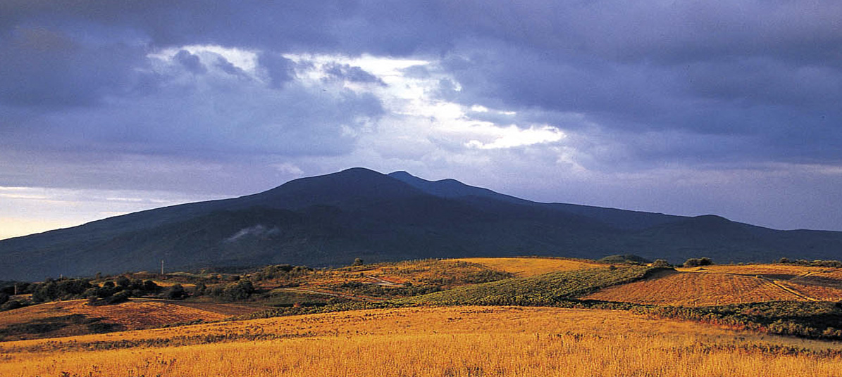
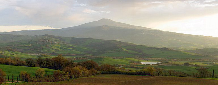
Monte Amiata is a unique presence in the landscape of Maremma. It is the only mountain of the southern Tuscany and the highest Italian extinct volcano.
|
|||||||||
 |
||||||||||
Monte Amiata |
||||||||||
| The Monte Amiata |
||||||||||
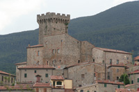
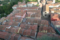
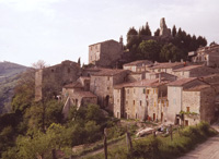
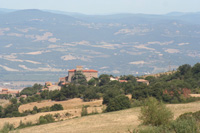
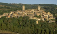
| Monte Amiata | Monte Amiata is the tallest mountainous territory in the Tuscan Maremma at 1738 metres and is located between Siena and Grosseto. Monte Amiata has, is and always will be the rugged heart of the Maremma. Home to the territory’s most ancient roots and traditions, as well as its purest natural beauty. Monte Amiataoffers a wide variety of history and culture, spectacular scenery and a fascinating history stretching back to the Etruscan civilisation before the arrival of the romans. There aren’t many towns around Monte Amiata, but they’re all renowned for their extreme natural beauty and historical legacy: Arcidosso, Castell'Azzara, Castel del Piano, Cinigiano, Roccalbegna, Santa Fiora, Seggiano, Semproniano. |
|||||||||
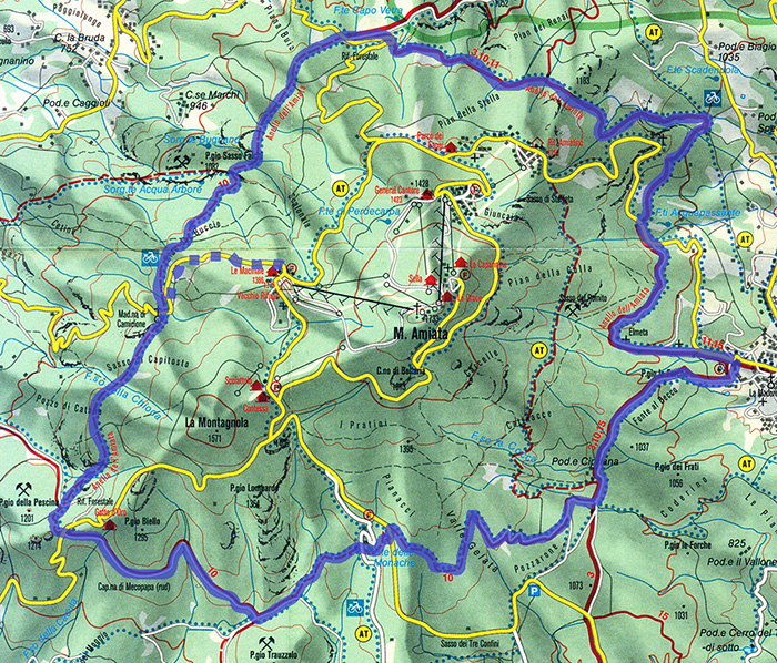
Hiking on Mount Amiata The Anello Monte Amiata
|
||||||||||
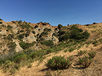
The desire to experience all things slowly is part of the very important and growing "Slow Movement" worldwide. The different aspects of southern Tuscany can be discovered during a long walk or hike. For people who enjoys hiking, Mount Amiata offers a large variety of paths. Monte Amiata is the largest beech wood in Italy. A network of paths follows ancient tracks of mushrooms and fruit gatherers, linking the various villages around the mountain.
|
||||||||||
 |
||||||||||
| The Ring of Amiata is a circuit with several paths to go walking, cycling or riding..
|
||||||||||
The mountain is an ideal place to discover on foot and the Agenzia per Il Turismo Monte Amiata proposes 34 itineraries of varying difficulty. This network of trails crisscrosses Amiata, uniting the mountain towns between themselves and the peak, and allowing the gathering together of an extraordinary natural and cultural patrimony.
Trekking and hiking on Mount Amiata | Trails to discover the beauty of Mount Amiata
|
||||||||||
|
||||||||||
|
||||||||||
Trekking sul Monte Amiata | Sentieri per scoprire le meraviglie del Monte Amiata (It)
|
||||||||||
| Rising at the feet of Monte Amiata, in the province of Grosseto, the town is famous for the extraordinary beauty of its zone, characteristic for ancient structures and for the great fascination of its panorama and scenery, which offer views of the mountains, the hills and the countryside. The park is located inside the Natural Reserve of Monte Labbro. It occupies about 200 hectares and is a facility dedicated to the study, protection and preservation of some animal species that live inside large semi-free areas. The park is divided into a series of paths and nature trails created for educational purposes and education, and provides the environmental guides to accompany visitors. Among the animals in the park there are the Apennine wolf , which can be seen from a roof terraces spread along the route of the visit, the Sorcino crusader, the Egyptian vulture, wild boar and ungulates such as deer, chamois, roe deer and mouflon. This is not our favorite place for hiking. From Arcidosso to the Fonte alle Monache and Santa Fiora -14 km Castel del Piano - Arcidosso (± 55 minutes) | Map - download pdf |
|
|||||||||
| Castel del Piano | Though Castel Del Piano is the main commercial center of this area, this town also has an interesting cultural heritage. The Ring of Amiata is a circuit with several paths to go walking, cycling or riding. The n° 4 is a trip of 6,5 Km.: it connects Casteldelpiano and Seggiano going under Montegiovi and by some small churches.
|
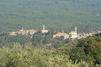 Castel del Piano |
||||||||
| Seggiano rises on a buttress placed along the north-western side of the Amiata mount. It was founded at the time of the Etruscans and it is set amidst beautiful landscapes. Among the most important monuments to see in Seggiano we point out here the Santuario della Madonna della Carità, the Chiesa di San Rocco, the Parrocchiale di San Bartolomeo and the Castello di Potentino. Santuario della Madonna della Carità The Santuario was built between 1589 and 1603 is important for the trachyte façade in Baroque-style and is characteristic for its Dome in red bricks. On the principal wall, the church has a fresco representing the Annunciazione and the interior hosts seven different kinds of altars. Il Giardino di Daniel Spoerri. At the beginning of the Nineties the Swiss Artist Daniel Spoerri established a sculpture garden in the South of Tuscany, Il Giardino di Daniel Spoerri. It has been opened for the public in 1997 and can be visited from Easter until October. There are 87 installations by 42 artists in an area of about 16 ha. Directions Castello di Potentino The castle of Potentino was the protagonist of Seggiano's medieval history. It was built around the year 1000. At the beginning, this fortress belonged to the Abbey of San Salvatore, before Siena took it in the XIII century. The Castle of Potentino is situated on the right hand side of the Vivo River, about 1,5 km from the centre of Seggiano, direction Montegiovi. From Seggiano to Castel del Piano and Arcidosso | 9 km
| ||||||||||
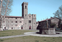
| Vivo d'Orcia | Vivo d'Orcia is a splendid outlying district of Castiglion d'Orcia, set in a valley outside time. At the foot of the castle, the river Vivo runs whose sources rise in the locality of Ermicciolo. Starting in the middle ages flour-mills, paper-mills and ironworks were built along the torrent and, in the 1920’s, one of the first hydroelectric power stations. Traces of these old buildings, covered with climbing plants, may still be seen here in one of the area’s most beautiful and evocative landscapes. Vivo d'Orcia preserves a marvelous hermitage, the Palazzo Cervini and the Romanesque Chapel dell'Ermicciolo. A short way from the centre is the Eremo del Vivo (or County), a palazzo of late Renaissance form designed by Antonio da Sangallo the younger. From the sources of the Vivo reservoir, which supplies Siena and Val di Chiana, an ascent road among beech and chestnut trees leads to the little church of Ermicciolo and the characteristic drying rooms or, as some experts put it, the first inhabited nucleus of Vivo d'Orcia. Walking in Tuscany | Val d'Orcia [1] Walking in Tuscany | Val d'Orcia [2]
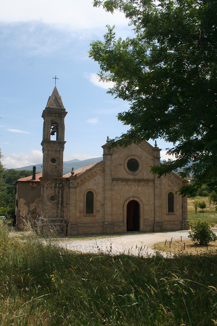
|  Borgo dell'Eremo and Chiesa di San Marcello |
||||||||
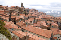
| Radicofani | Radicofani is characterized by the presence of the Rocca, which dominates the Orcia valley from south. The tower that can be seen from everywhere in the valley, has been rebuilt in the XIX century. The Rocca is rich of historical and literary memories concentrated on the figure of the legendary master Ghino di Tacco whose life was described by Dante and Boccaccio. The village of Radicofani maintains the original structure and keeps nearly intact its architectural characteristics of the thirteenth century. In the Romanic Chiesa di San Pietro you can find a precious collection of glazed earth ware and some beautiful wooden statues. Outside the built up area rises the Palazzo della Posta, an ancient shooting lodge of Ferdinando I, built in the sixteenth century. |
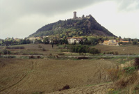 Radicofani |
||||||||
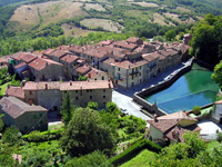
| San Casciano dei Bagni | San Casciano dei Bagni is a tiny village near Siena, situated between the Paglia and Chiana valleys and surrounded by the Cetona, Amiata and Radicofani mountains. The origins of the village of San Casciano dei Bagni go back to the Etruscan and Roman Ages, when the first thermal baths were built. At the foot of Monte Cetona, amidst oak and chestnut forests, there are forty-two springs, with 42 springs, a mean temperature of 42°C, rich in mineral salts, sulphate, calcium, magnesium and fluoride and a daily delivery of 5.5 millions litre. Apart from the Terme, the most important monuments to see in San Casciano dei Bagni are the Chiesa Basilicale, the Collegiata di San Casciano and the Oratorio di Sant'Antonio. |
 San Casciano dei Bagni |
||||||||
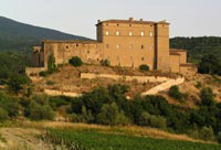
Villa La Foce |
Iris Origo (1902-1988), the Marchesa Origo, was an Anglo-Irish-American writer, who devoted much of her life to the improvement of the Tuscan estate at La Foce, near Montepulciano, that she purchased with her husband in 1924. The gardens and estate of La Foce constitute one of the most important and best kept early twentieth-century gardens in Italy. Passionate about the order and symmetry of Florentine gardens, she and her husband employed the English architect and family friend Cecil Pinsent, who had designed the gardens at Villa Medici, to reawaken the natural magic of the property. Gardens in Tuscany | Villa La Foce | 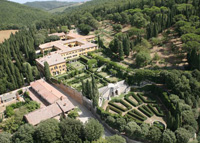 Villa La Foce |
||||||||
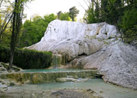
| Abbadia San Salvatore | Abbadia San Salvatore lies on the edge of extensive chestnut woods covering the eastern side of Monte Amiata and is one of the oldest monasteries in Tuscany. In the mediaeval period, it was an important station on the Via Francigena, the pilgrim route from northern Europe to Rome. The picturesque medieval borgo or village round the monastery has one of the best preserved mediaeval centres of Tuscany. It preserves its outer walls and streets intact, with medieval and Renaissance houses of locai grey stone. Bagni San Filippo is an enchanting small town, situated in a splendid position between the woods of Monte Amiata and the wonderful countryside of Val D'Orcia. In this small hamlet huddled around its hot springs, even the eye gets relief from looking at the imposing calcareous formations of the Fosso Bianco, some sort of petrified cascade that, immersed in the forest, will leave you filled with wonder. |
|||||||||
| Bagni San Filippo | Monte Amiata is endowed with sulfur-rich springs thanks to the volcanic activity. One of the most beautiful and lesser known hot springs in Tuscany, Bagni San Filippo is located at the foot of Monte Amiata. Bagni San Filippo is a village within the municipality of Castiglione d'Orcia in the Val d'Orcia. This enchanting corner of Tuscany takes its name from the hermit saint who chose to live his solitary life here at the end of the 13th century, and owes its fame to the beneficial properties of its five hot springs with a temperature of 52°C. The symbol of Bagni San Filippo is the Balena Bianca (or White Whale), the name of the most suggestive and evocative of the waterfalls here. The Balena Bianca seems but a large mass with a crustacean's mouth, a form that arose from the thermal water's sediments. San Filippo is only half an hour away from Bagno Vignoni and it has a similar past: the waters of San Filippo were known by Romans, became famous in Middle Ages, treated famous people like Lorenzo il Magnificio and other princes of the Medici family. |
|||||||||
| Piancastagnaio | Piancastagnaio has a circular form, once had surrounding wall enclosure with alternating square towers and four gates. The walls and the gates have been almost entirely demolished, with the exception of few lines, but in the highest point of the inhabited area rises still today the mighty Fortress Aldobrandesca. An old miners’ path leads to Abbadia San Salvatore. La Riserva del Pigelleto | Pigelleto Natural Reserve Piancastagnaio The Pigelleto Nature Reserve in Piancastagnaio, between Siena and Grosseto, extends over a territory of 862 hectares. There are many excursion paths that run through the Nature Reserve of Pigelleto. Some paths are part of the marked trail n° 16 (Saragiolo - Miniera del Siele - Castell'Azzara) and n° 17 (Pod. La Roccaccia - Castell'Azzara) created by the Town of Monte Amiata. |
 Piancastagnaio |
||||||||
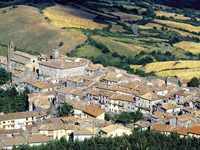
| Santa Fiora | Santa Fiora, a medieval town at an altitude of 800 metres, is situated at the foot of Monte Amiata, and is regarded as one of the most beautiful natural environments in Italy. The imposing Palazzo Sforza Cesarini was built in 1575 over the Aldob randeschi Castle, of which two medieval towers can be still seen. The village has some fine churches. The Pieve delle Sante Flora e Lucilla, reached on Via Carolina from the square, was named after two local saints whose relics were brought here in the eleventh century. A steep lane leads to the Chiesa di Sant'Agostino, which possesses a fine painted wooden image of the Madonna and Child, attributed to Jacopo della Quercia. Down the road you come to gardens and the oratory of Chiesa della Madonna della Neve and then to the village's nicest feature, the Peschiera, a spring-fed lake and 18th-century garden surrounded by woodland and gurgling brooks. Santa Fiora was chosen as the ideal location for the International Festival Santa Fiora in Musica. From Santa Fiora to Selva | 9 km The first part of the mountain crossing from the summits of Amiata to Mount Civitella and Castell' Azzara includes long sections on asphalted roads. It descends to the valley of the Fiora River and rises again along the Scabbia River Valley before arriving at the Convent of Santissima Trinita. |
|||||||||
Castell'Azzara |
Castell'Azzara is a splendid and animated town. It sits on the feet of the famous Tuscan mountains, in the southern territory of the Maremma. The ancient village is situated in the northern part of the Area dell'Tufo (Tuff Area) and is one of the most fascinating and interesting locations the Maremma. The Monte Penna Nature Reserve and the Pigelleto Nature Park are must-see stops for nature lovers who want to know more about the territory’s unique geological characteristics In Siele, the mining village located in the National Mining Park of the Amiata, you can learn all about the area’s old-time industries. Travelling by bike along the trails of Lunigiana, make your way amidst castles and Romanic churches, located on the Via Francigena or cycle along the Via del Volto Santo link, where you can follow the footsteps of ancient pilgrims during their spiritual journeys throughout the area. From Selvena to Castell'Azzara | 7 km
| |||||||||
| Roccalbegna dominates the valley of the river Albegna at the slopes of mount Labbro, south of the Mount Amiata. The Chiesa Maggiore dei Santi Pietro e Paolo dating back to the XIII century, is in Romanic style and conserves an altar piece considered to be one of the most significant masterpieces of Ambrogio Lorenzetti. The Castello di Triana, 6 kms from the town of Roccalbegna, sits on a rocky promontory and is enclosed by medieval stone walls South of Roccalbegna, the centre of Semproniano still maintains this charming medieval feel with its quaint alleyways and picturesque stone houses. Going down towards Saturnia, shortly outside of Semproniano up on a rock along the Albegna river, rises the medieval village of Rocchette di Fazio, dominated by the ruins of the Rocca Aldobrandesca. The area around Roccalbegna offers some interesting walks among the various nature reserves. This pleasant itinerary leads half way along the solitary valley of the Albegna River, crossing many valleys to arrive at the picturesque village of Rocchette. The first two kilometres are on an asphalt road, the resst along a tranquil gravel road, arriving at Semproniano (another 3km).
|
|
|||||||||
Enlarge Map |
||||||||||
| Cinigiano - Castiglioncello Bandini | The fraction of Castiglioncello Bandini, only 2,5 km away from Podere Santa Pia, belongs to the municipality of Cinigiano, at the foot of Poggio all'Olmo Nature Reserve, and is dominated by a splendid castle. Walking in southern Tuscany | Itineraries exploring Castiglioncello Bandini and the Mediterranean macchia in the valleys around the village
|
|||||||||
Walking in Tuscany, by Gillian Price. Sheet 40/41.Monte Amiata, Val d'Orcia. Castel del Piano, Arcidosso, S. Fiora, Abbadia s. Salvatore, Piancastagnaio, Roccalbegna, Seggiano, Radicofani, Castiglione d'Orcia, Bagno Vignoni. |
||||||||||
|
||||||||||
|
||||||||||
 |
||||||||||
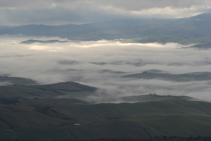
Radicofani, vista panoramica su Monte Amiata e sulla Val di Chiana
|
||||||||||
Sentieri Monte Amiata | map | www.amiatarunners.com |
||||||||||