Slow food and slow travel are part of a movement to return to traditional ways of traveling and
|
||||||||||
Wandelen in Toscane | Trekking in Toscane | Schilderachtige paden in een uniek landschap
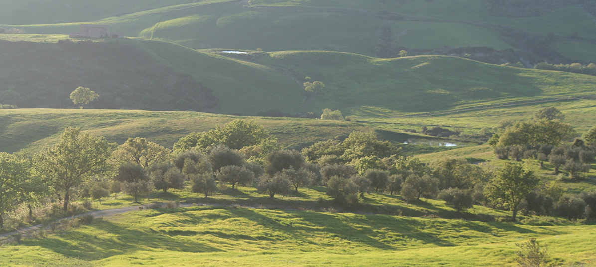
Van alle manieren van reizen is wandelen wellicht de meest intieme en ook onze meest natuurlijke wijze om onze omgeving te verkennen. Het is de ultieme manier om een te zijn met de natuur. Tijdens een wandelvakantie en vooral tijdens meerdaagse wandeltochten kom je op plekken waar je doorgaans niet kan komen of die je niet kon voorzien. Wandelen in Toscane geeft je een vaak over het hoofd gezien en onderschatte relatie met je omgeving - en hier zijn ze echt geweldig. Lopen dwingt je om te communiceren, je tijd te nemen en de wereld rondom in te ademen. Nergens anders ter wereld worden deze immateriële voordelen meer gevierd op het beroemde Italiaanse platteland van Toscane. Zuid-Toscane is een onontdekt juweel, het gebied biedt zowel een cultureel als een natuurlijk feest. Een wereld buiten de gebaande paden, waar beboste heuvels, valleien, rivieren en meren een uniek historisch en archeologisch paradijs omlijsten. Van de Etrusken tot de Romeinen en van de Middeleeuwen tot de Renaissance tot onze huidige tijd, de geschiedenis van de mensheid heeft laag na laag zijn sporen achtergelaten in een ongelooflijke opeenvolging. Het is moeilijk om ergens anders zoveel herinneringen aan verschillende tijdperken te vinden en in zo'n speciale setting. Wat zijn de mooiste plekken om te wandelen in Toscane? Het landschap is er bijzonder gevariëerd, van de beroemde heuvels van de Val d'Orcia, tot het krijtlandschap van de Crete Senesi, van de beboste heuvels ten westen van Siena, de Montagnola Senesi, tot de cultureel geladen etappes van de Via Francigena. We wandelen langs de uitgestrekte wijngaarden rond Montalcino en Montepulciano, gaan op ontdekking in de Chiantistreek of verkennen de oude wandelpaden rond de dode vulkaan Monte Amiata, of de Via Cave, die bijzondere Etruskische paden die duizenden jaren oud zijn.
Het vakantiehuis Podere Santa Pia is het natuurlijke hart voor wandelaars in het zuiden van Toscane en heeft een breed assortiment aan wandelkaarten en wandelgidsen over Toscane verzameld. Het natuurhuis ligt centraal in de Toscaanse Maremma, een nog nauwelijks ontgonnen en wild deel van Toscane.
|
||||||||||
|
||||||||||
|
|
||||||||||
wandelKaart Montalcino | Val d'Orcia | Pienza |
||||||||||
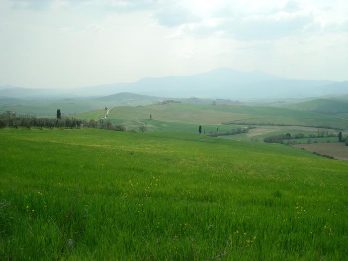
Immerse yourself into the rhythms of la dolce vita on an unforgettable journey through the Val d’Orcia, explore the winding cipress roads and architectural wonders around San Quirico d’Orcia, Pienza and Montalcino with our Hiking Suggestions.
|
||||||||||
 |
||||||||||
Wandelen in de Val d'Orcia, prachtige landschappen tussen Monticchiello en Pienza |
||||||||||
 |
||||||||||
Montagna Cornate di Gerfalco, Gerfalco, Montieri, Provincia di Grosseto [1]
|
||||||||||
De Colline Metallifere vormen een bergachtige streek in het westen van Toscane. Het gebied is gelegen tussen de Tyrrheense Zee en de rivieren Ombrone en Cecina.
|
||||||||||
 |
||||||||||
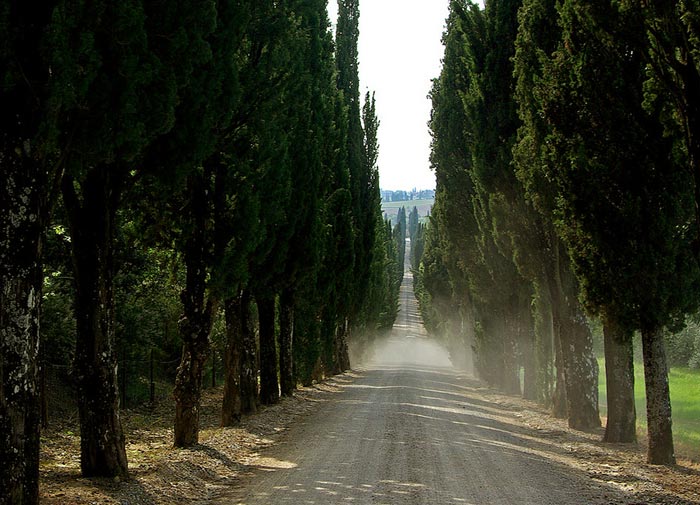
Villa Arceno near Castelnuovo Berardenga and Siena, reached by rows of centuries-old cypress trees |
||||||||||
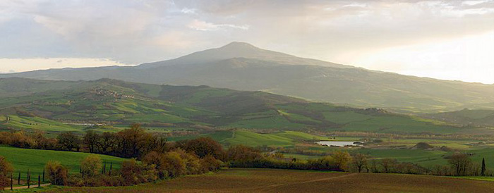
| The mountain is clothed in a forest of beeches, oaks, firs and chestnut trees, stretching from a height of a thousand meters to the top of the mountain. The summit of Monte Amiata is 1738 meters above sea level and this extinct volcano today marks the border between the provinces of Siena and Grosseto in southern Tuscany. This is where the territory of the Maremma meets the Val D’Orcia. The Etruscans considered Monte Amiata their Mount Olympus and the fertile land, mineral deposits and thickly forested slopes have been inhabited by a proud and independent people since prehistoric times. The volcanic eruptions finished 180 thousand years ago and many huge boulders still dot the slopes where they landed. The mountain is an ideal place to discover on foot. A network of hiking itineraries cover both sides of the mountain. The Agenzia per Il Turismo Monte Amiata proposes 34 itineraries of varying difficulty following the old mule trails and traditional paths which make up over 200 kilometers of trekking. About 12 hours are needed to complete the circle, the Anello dell'Amiata, indicated by the characteristic red and white signs, but there is also a choice of stretches for shorter walks. |
||||||||||
 |
||||||||||
|
||||||||||
The area of Pitigliano and far to the south of Rome is characterised by tuff stone, a hardened type of volcanic magma. Southern Tuscany was once one of the most important centres of the Etruscans. There are numerous cave-tombs of that period around Pitigliano, caves cut deep into the tuff, that are today used as cellars and sheds. The Tuff Area is named after tufo, a volcanic, porous rock commonly used as a building material. The tuff has been carved over the centuries to build houses, cellars, tombs or used to make "tufi", big square bricks which are typical of the villages and towns of this area of the hills of the Maremma.
|
||||||||||
 |
||||||||||
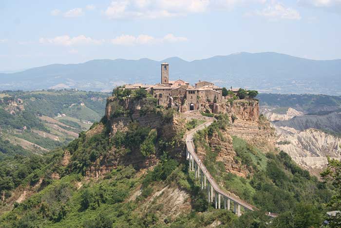
Civita di Bagnoregio |
||||||||||
| The Maremma landscape is varied. Hills gently degrading towards the sea, whose main colours are intense green in spring and golden yellow in summer, with the presence of olive-groves and vineyards and also woods of cork-oaks and flowering ash full of mushrooms if it rains in summer. The fertile plain too is accurately cultivated and studded with the white rural houses. Many pine forests grow along the coast, wide shores of very fine siliceous sand with its characteristic sand dunes rich in Mediterranean macchia, the brush. Maremma includes 160 km of shoreline. The stretches of sandy and rocky coastline allow all sea lovers to find the perfect place for them. Moreover, the vast pine tree forests which border the beaches of the Maremma are a real naturalistic treasure and so are the few areas where the lagoon and swamp ecosystems have survived urbanization, reclamation or simple draining, such as the nature reserve of the Diaccia Botrona near Castiglione della Pescaia, and the Parco Naturale della Maremma between Alberese and Talamone. Grosseto can be considered the capital of the Maremma. The area around Grosseto and the coast, with Marina di Grosseto, Castiglione della Pescaia and the small villages that lie in the plain between the city and the coast, represents the heart of the Tuscan Maremma. Inside the Follonica Gulf, in the Bandite di Scarlino reserve, which is divided by a small promontory from Punta Ala, among a multitude of small caves, you will find Cala Violina. The beach's name derives from its very rare characteristic (it appears there is only one another beach with such a peculiarity) by which, steeping on the sand, the latter will echo back the harmonious notes of a violin. |
||||||||||
 |
||||||||||
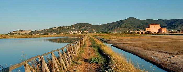
The Natural Reserve of Diaccia Botrona, near Castiglione Pescaia |
||||||||||
In het zuiden wordt de Tombolo della Feniglia beschouwd als het meer chique en mooie strand. Het natuurreservaat Bandite di Scarlino ligt ten zuiden van Puntone di Scarlino. De glooiende heuvels met steeneiken, kurkeiken en aardbeibomen zijn een mooi wandelgebied, en verbergen enkele van de mooiste stranden van Toscane.
|
||||||||||
 |
||||||||||
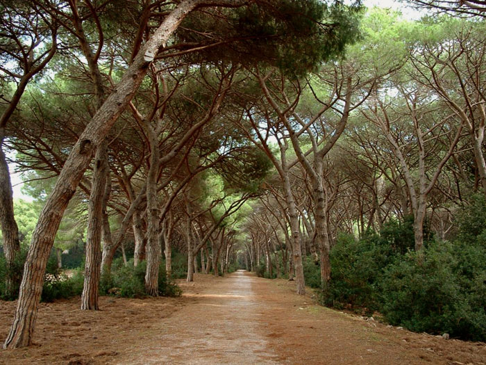
Tombolo della Feniglia, a forest preserve of stone pine trees runs the length of the beach
|
||||||||||
 |
||||||||||
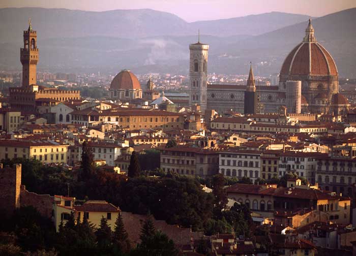
Florence, view from Piazza Michelangelo |
||||||||||
| Florence, the capital Tuscany, is known for its role in bringing Europe out of the Dark Ages and into the Renaissance era, paving the way for world-changing art, architecture, exploration, politics, and business. The Renaissance first occurred inFlorence and continued to be more pervasive there than anywhere else. The city's economy and its writers, painters, architects, and philosophers all made Florence a model of Renaissance culture. Most of the major tourist sights in Florence are within easy walking distance of each other. It is possible to walk from one end of the historic center of Florence to the other - North-South or East-West in a half hour. Walking is not only an easy way to get around, it also offers the chance to 'take in' much more of the city life. Be warned though, that electric motor scooters are small enough to fit where cars cannot. They are silent but quick and in the summer they often times travel into the plazas. Some of the streets in central Florence are closed off to traffic, and many more are simply too narrow for buses to get through. Therefore, bus and car tours are not recommended. This is a very small, very compact city that really needs to be seen by foot. This selection of tours has been put together with a deep passion for Tuscany's history and culture.
|
||||||||||
Archief | Lees hier de oorspronkelike beschrijving
|
||||||||||
